Tag Archives: Redwood National Park

End of Summer Redwoods Trip

A couple months ago (mid September 2023) I took a few days to visit the redwood parks and forests in Santa Cruz, Mendocino, and Humboldt counties in California.  I also caught up with a few redwood colleagues, it was nice visiting and doing some walking and hiking. 

Day One – Big Hendy and Little Hendy Groves in Hendy Redwoods State Park near Philo

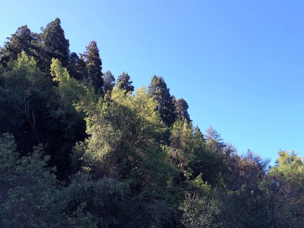
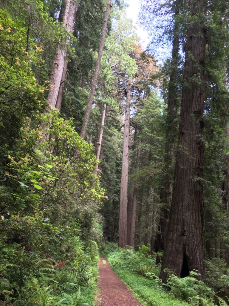
Big Hendy redwood grove has well maintained relatively flat trails that wind throughout the old growth area.  There are tall trees here, with twenty or so from 330-350 feet in height.   There is also a nice prairie area adjacent to the river and good picnic facilities.

Little Hendy redwood grove is a smaller though just as nice grove closer to the visitor center and is pretty much right above the banks of the Navarro River.   The primary trail is a single narrow oval loop with small elevation changes.  There are some large and unusual redwoods in Little Hendy Grove right along the loop.

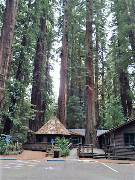
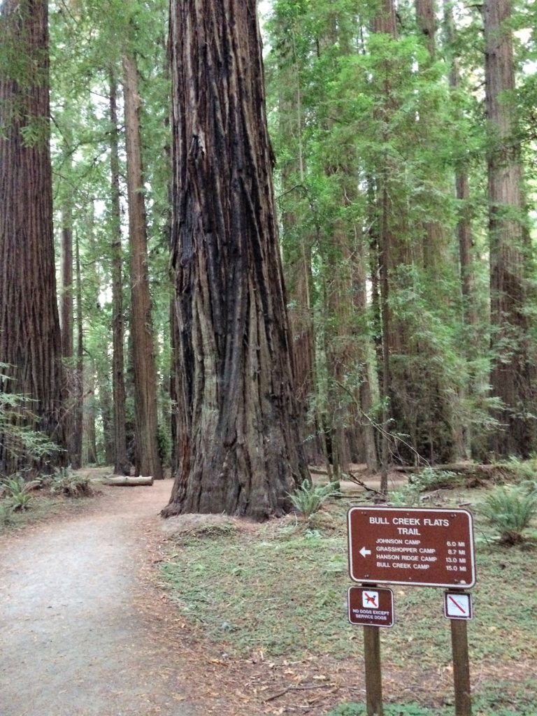
Day Two – Humboldt Redwoods State Park Bull Creek Groves

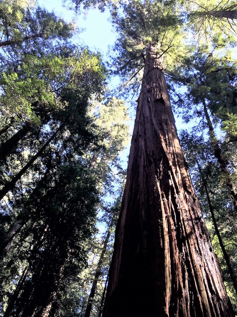
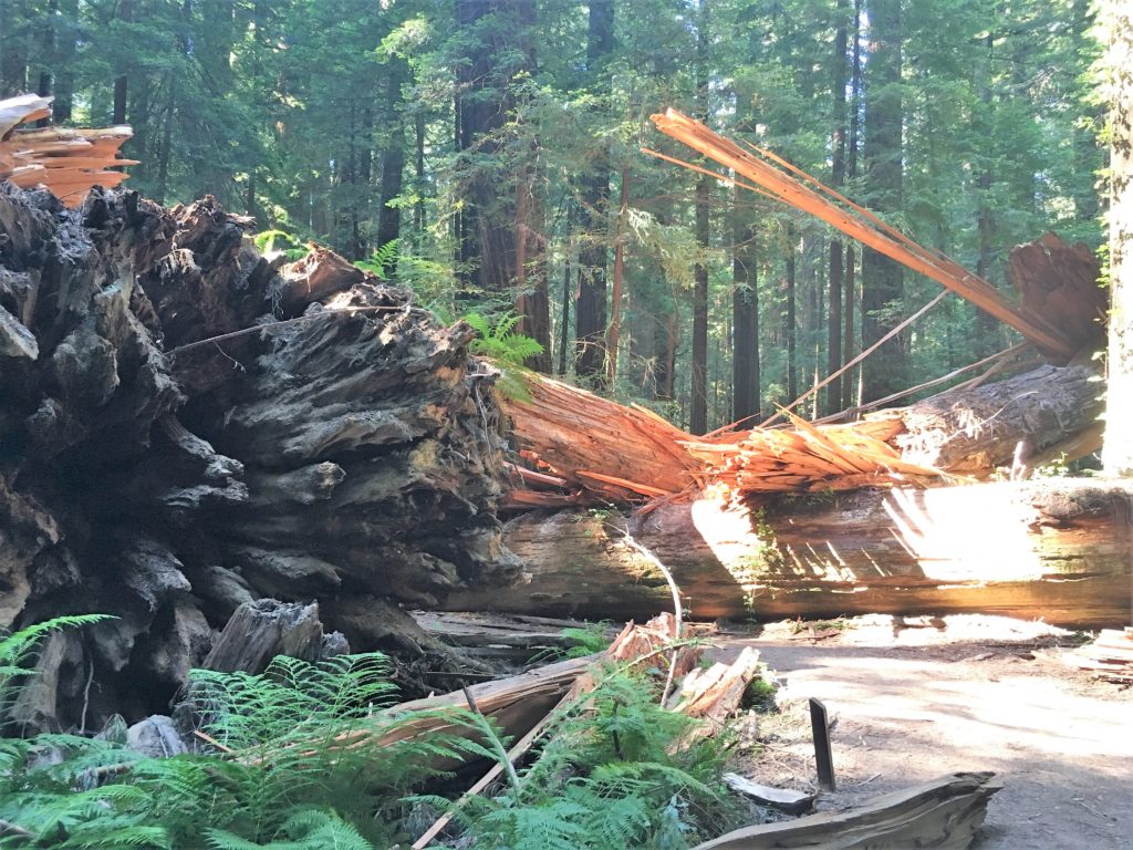
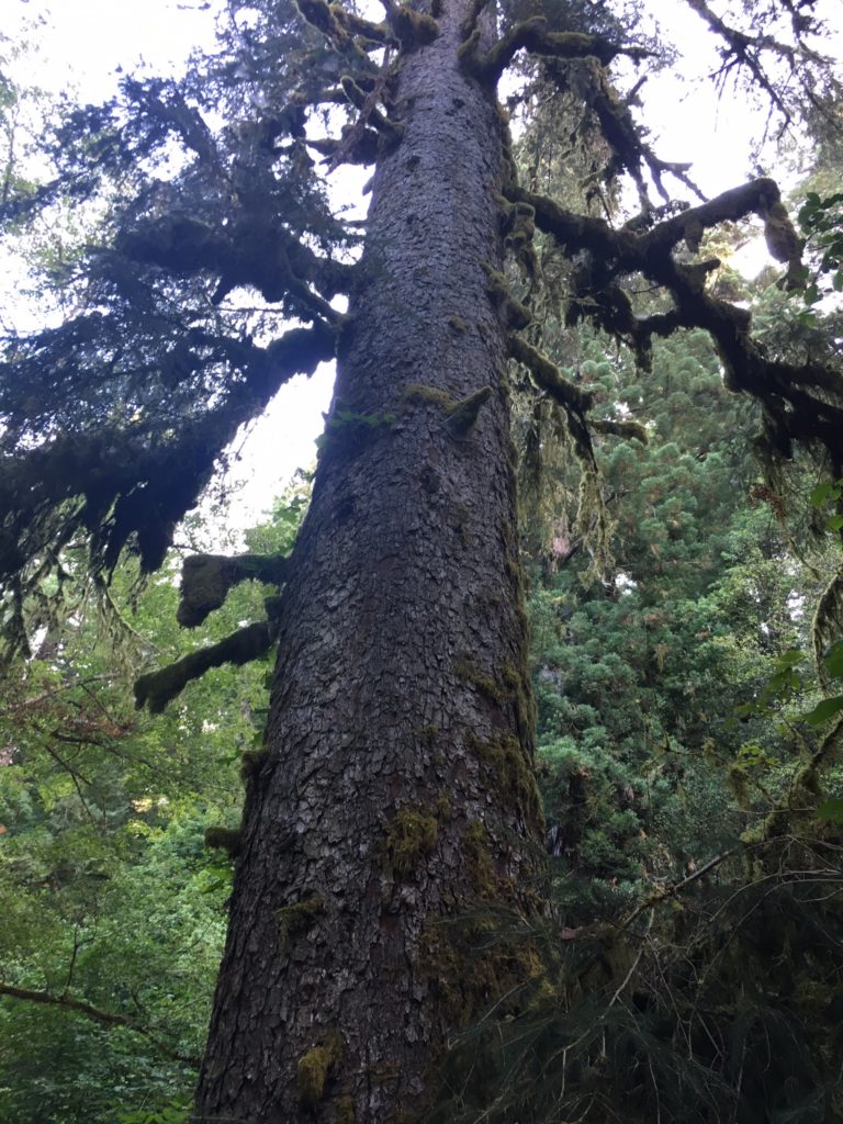
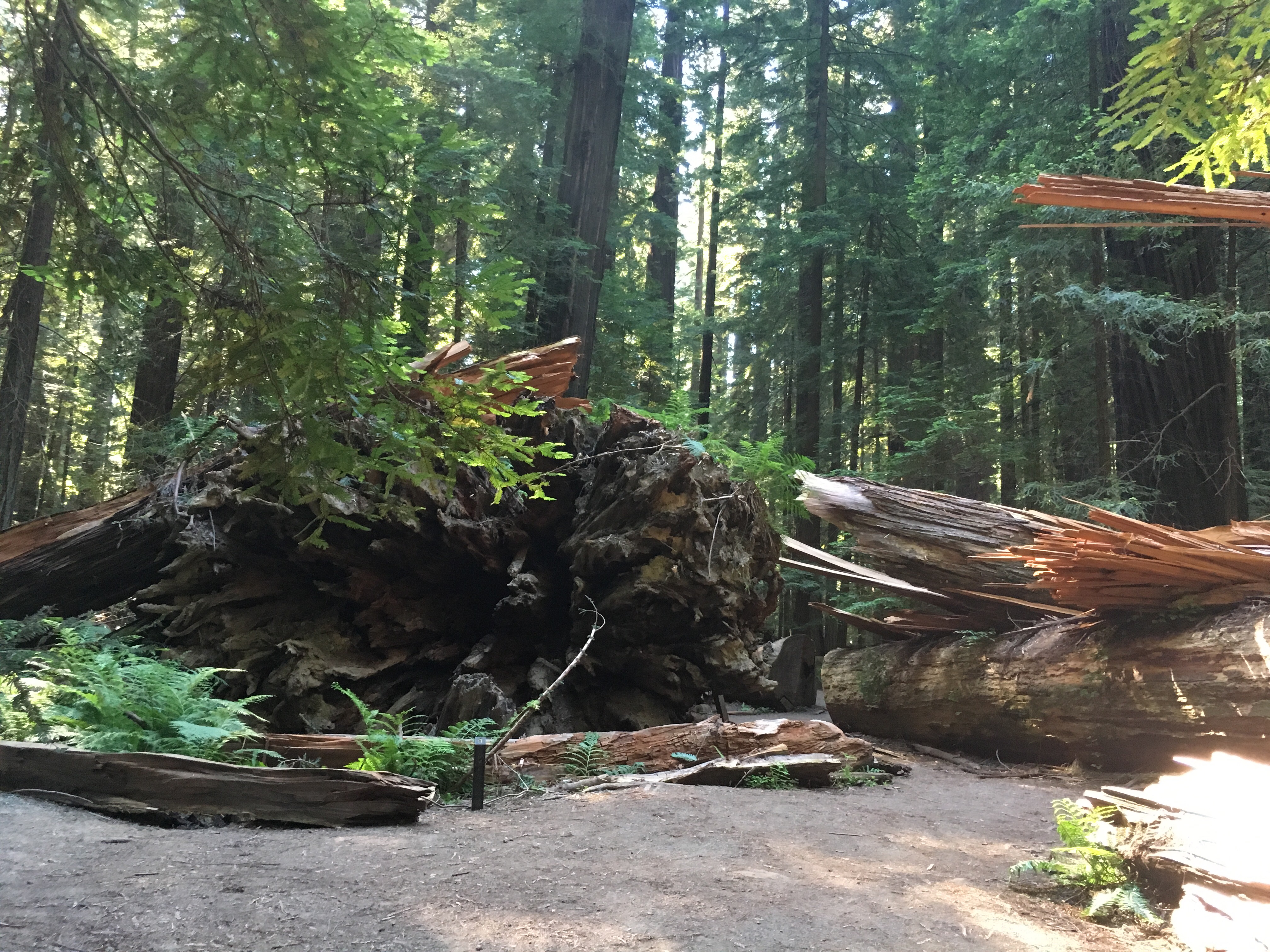
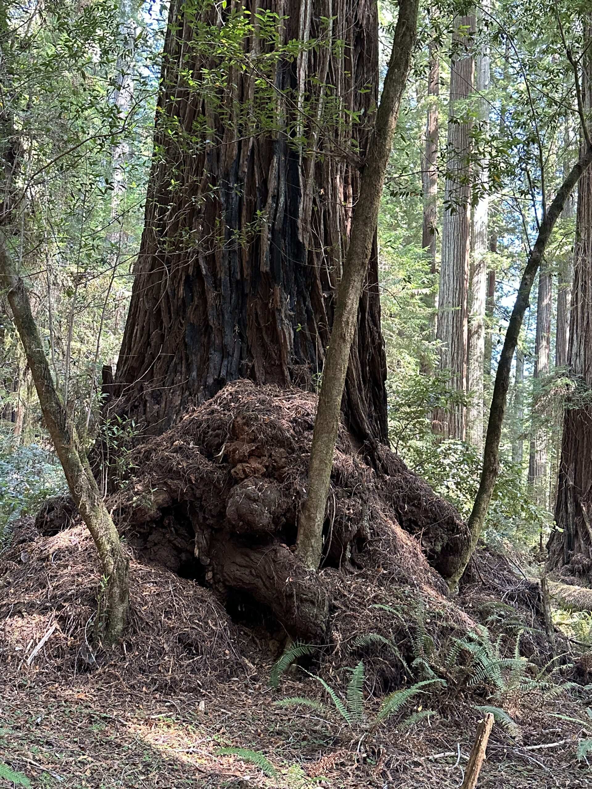
I met John (the Eagles fan John) in the Tall – Giant tree area off Mattole Road.  We did some hiking in the flats on both sides of Bull Creek.  There were a few downed trees, especially on the north side of Bull Creek.  The Giant Tree dropped a big limb or two recently, smashing through the deck surrounding it and destroying the sign beside the deck.  There is also a big deep hole in the ground on the west side of the Giant Tree, obviously involving the Giant Tree’s roots.  It is worrisome. 

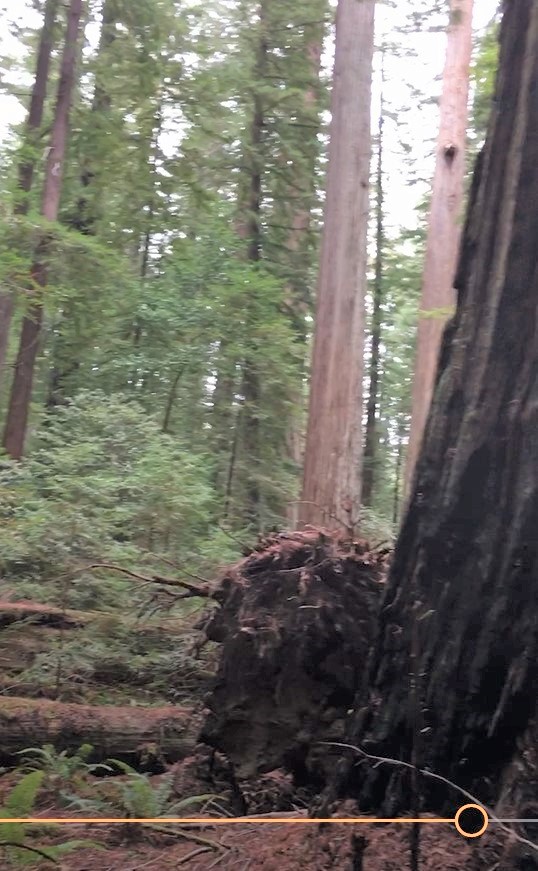
The drive along Mattole Road took me though the area where there was a big landslide last Spring.  About a quarter mile of the road is now gravel track, and there are many downed redwoods on the downhill side of Mattole Road through this area.

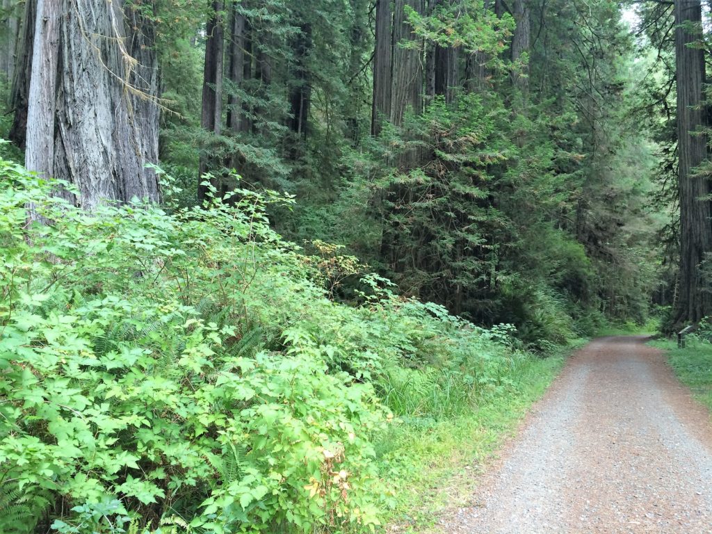
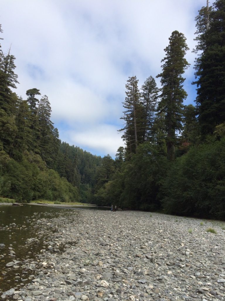
Day Three – Redwoods National Park Tall Trees Grove

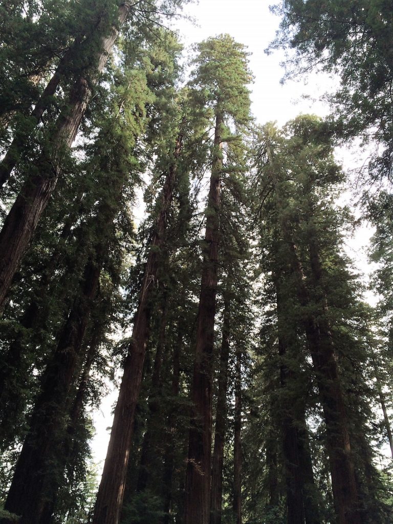
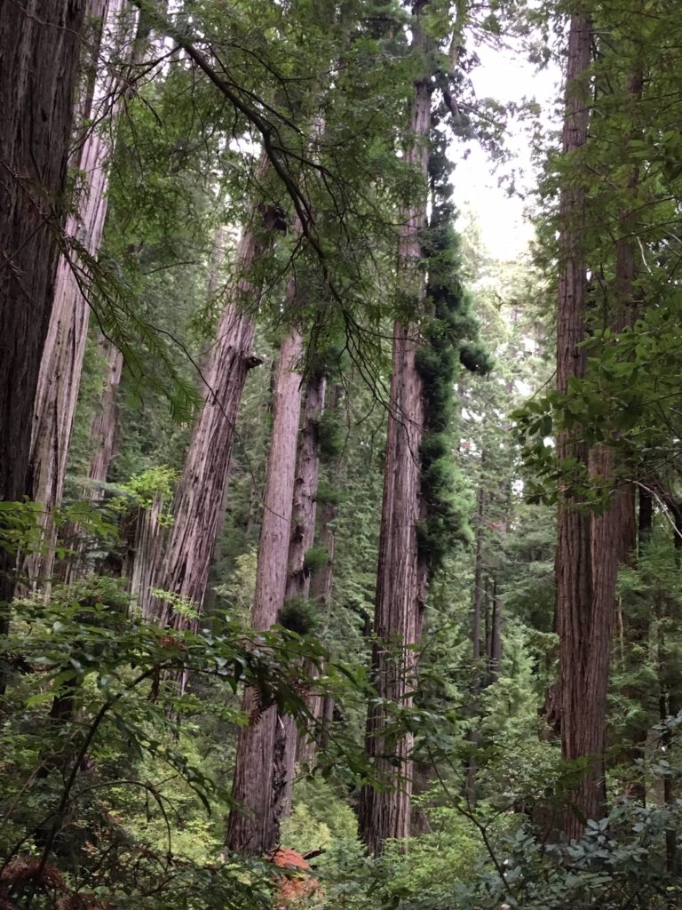
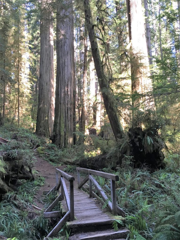
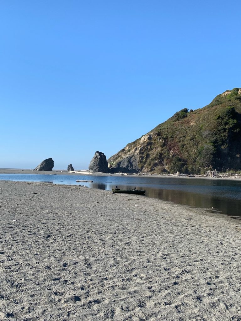
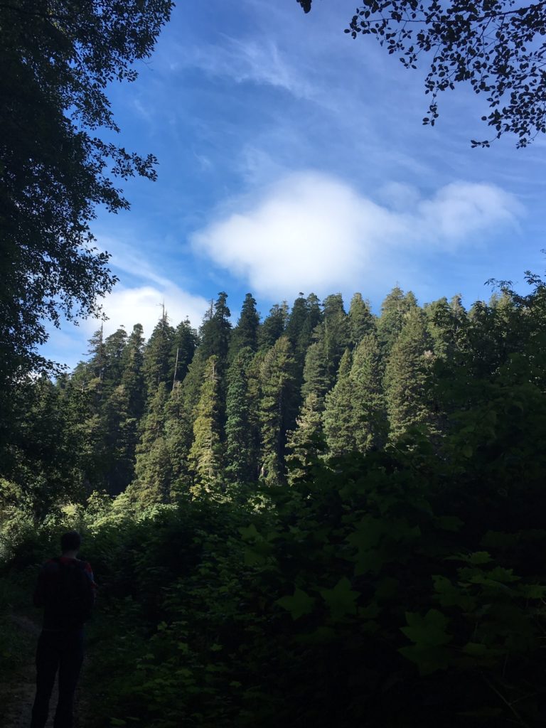
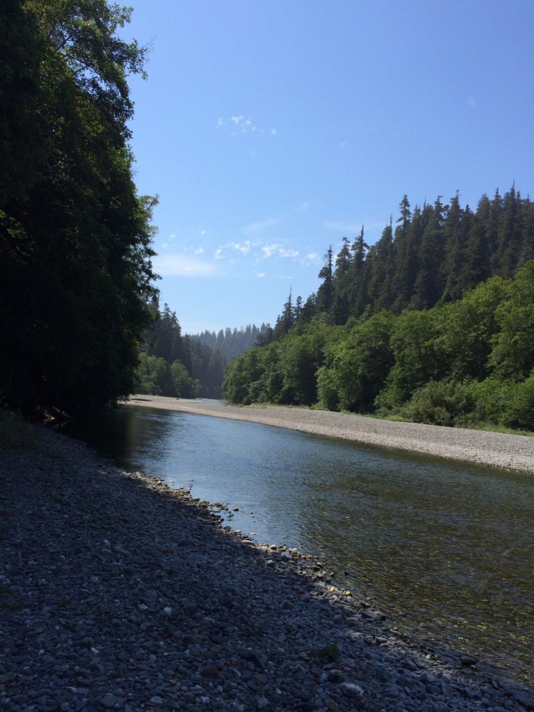
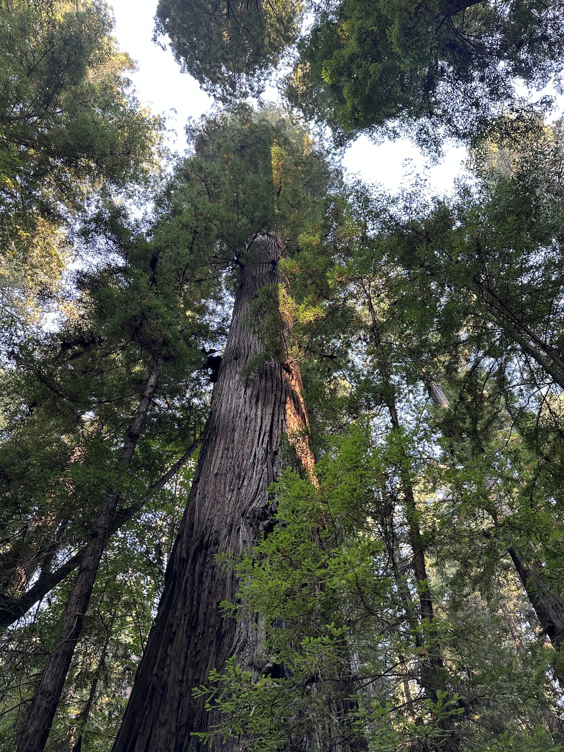
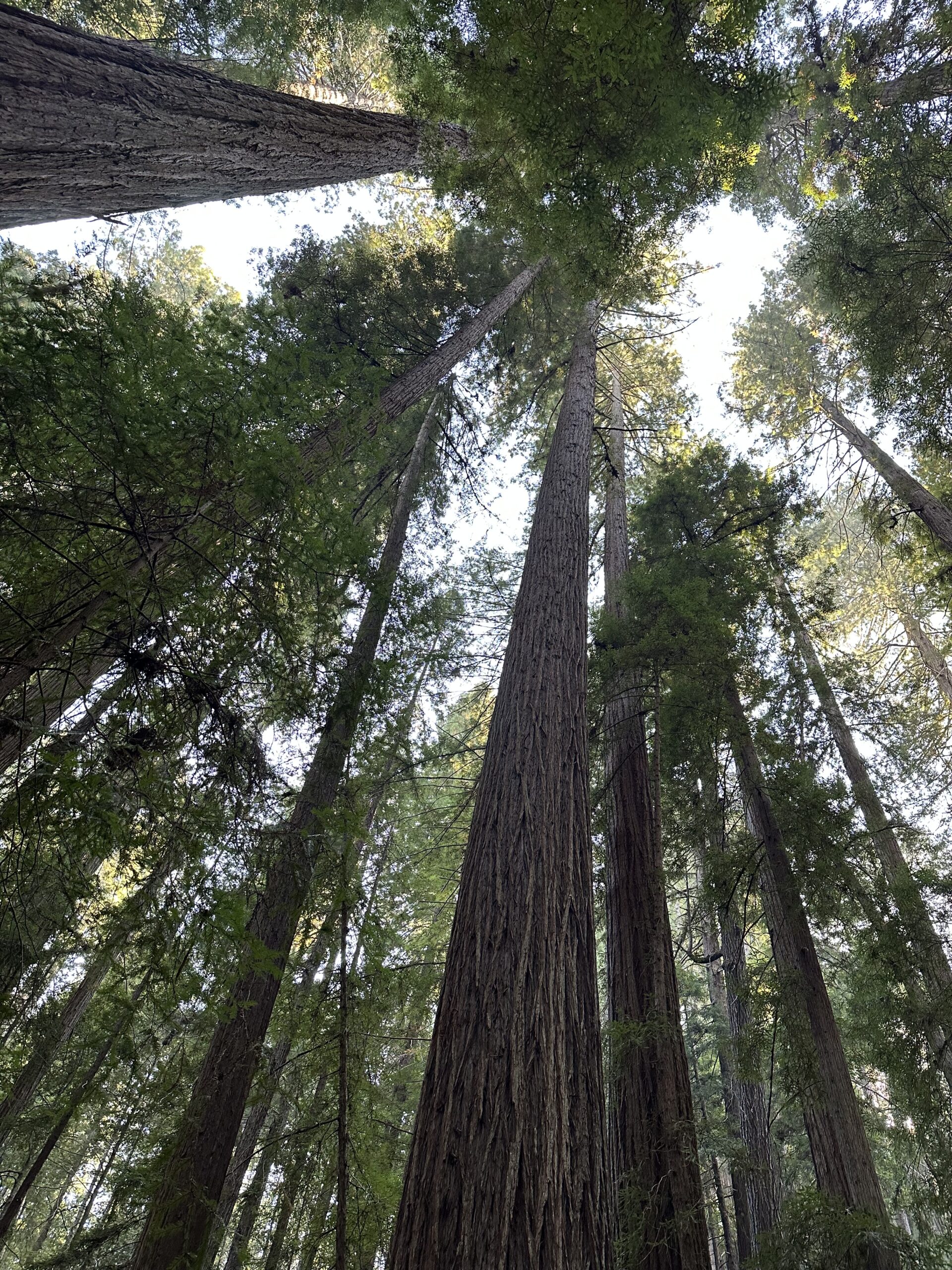
I really enjoy the drive and hike to Tall Trees Grove, and the grove itself is great.  In the summer walking out onto the gravel bars of Redwood Creek from the Tall Trees trail is a must to see the giants in profile.  These redwoods are huge living things.

There was a lot of tree fall along upper Tall Trees grove trail last winter and many well executed repairs are visible on the upper part of the trail.  Down in the grove itself all the giants seem to be standing tall.  I spent a lot of time on the gravel bars taking in the views, both immediate and long distant.  The hike back up the steep hill is a good leg and lung stretcher and I enjoyed respites on a couple of well positioned benches.

Day Four – Humboldt Redwoods Pepperwood Area, Smithe River State Natural Reserve, and Chamberlain Creek Waterfall Trail in Jackson State Forest Mendocino County

On day four I met Steve (the Cal Poly Humboldt Steve) and we did some hiking and work in the Pepperwood Area of Humboldt Redwoods State Park.   Most of the time we were in French Bell Grove, but we also went over to the north end of the Avenue to check out a few trees close to 101. 

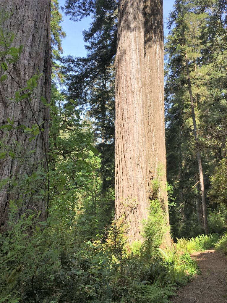
Later that day I finally stopped at Smithe Redwoods State Natural Reserve along 101 north of Leggett.  Care needs to be taken exiting and entering 101 from the adjacent parking area as this is a high-speed curvy area of the highway.  Smithe Redwoods are on a nice flat above the Eel River and there is some impressive old growth there. A couple trees top out at 330 feet.

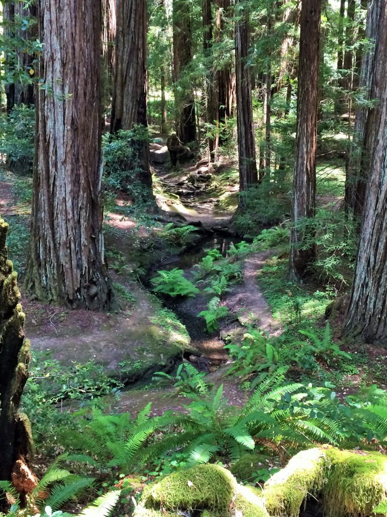
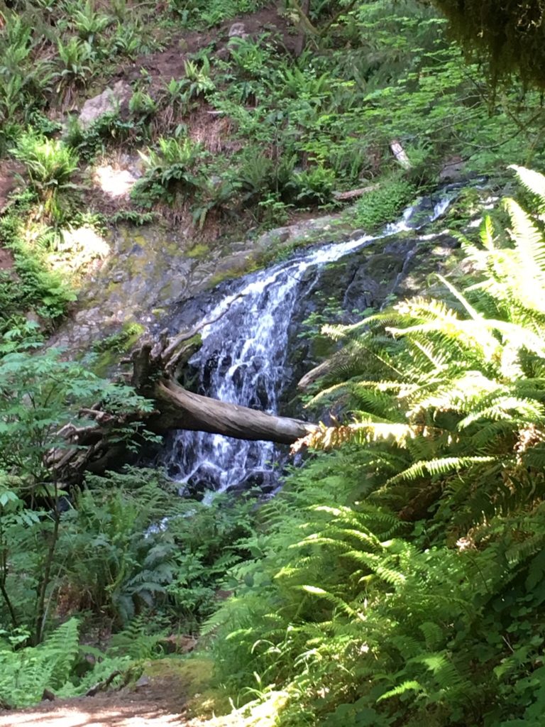
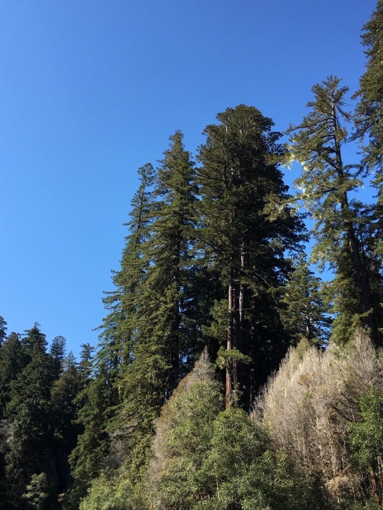
After this it was off to Chamberlain Creek Waterfall Trail between Willits and Fort Bragg in Jackson State Demonstration Forest in Mendocino County.  This area is a little remote and has gravel roads on the approach and it is good to have well researched written directions when driving there.  The trail is great, it starts from a road and moves sharply downhill into a creek valley filled with tall old growth redwoods.  The waterfall was flowing, and the wide cascade drops straight down a twelve foot or so wall of rock.  The waterfall and redwoods are in the same immediate area, so the vista is scenic and tranquil.

Big trunk and crown of large redwood in Grieg-French-Bell grove

Day Five – Henry Cowell Redwoods State Park and Aptos Creek in Santa Cruz County

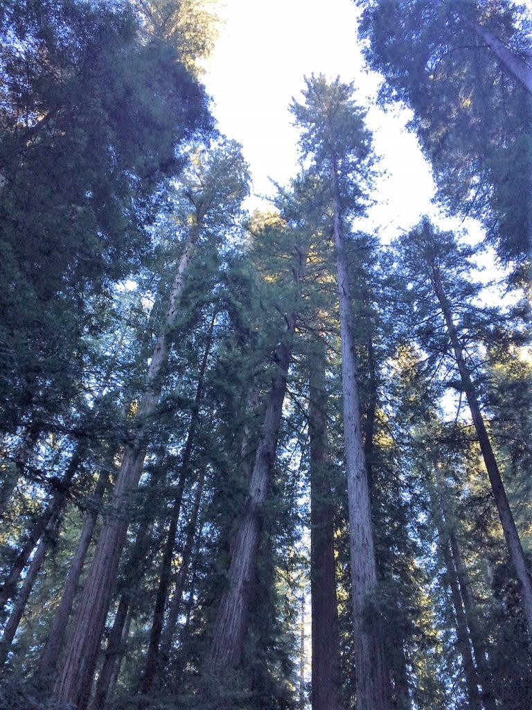
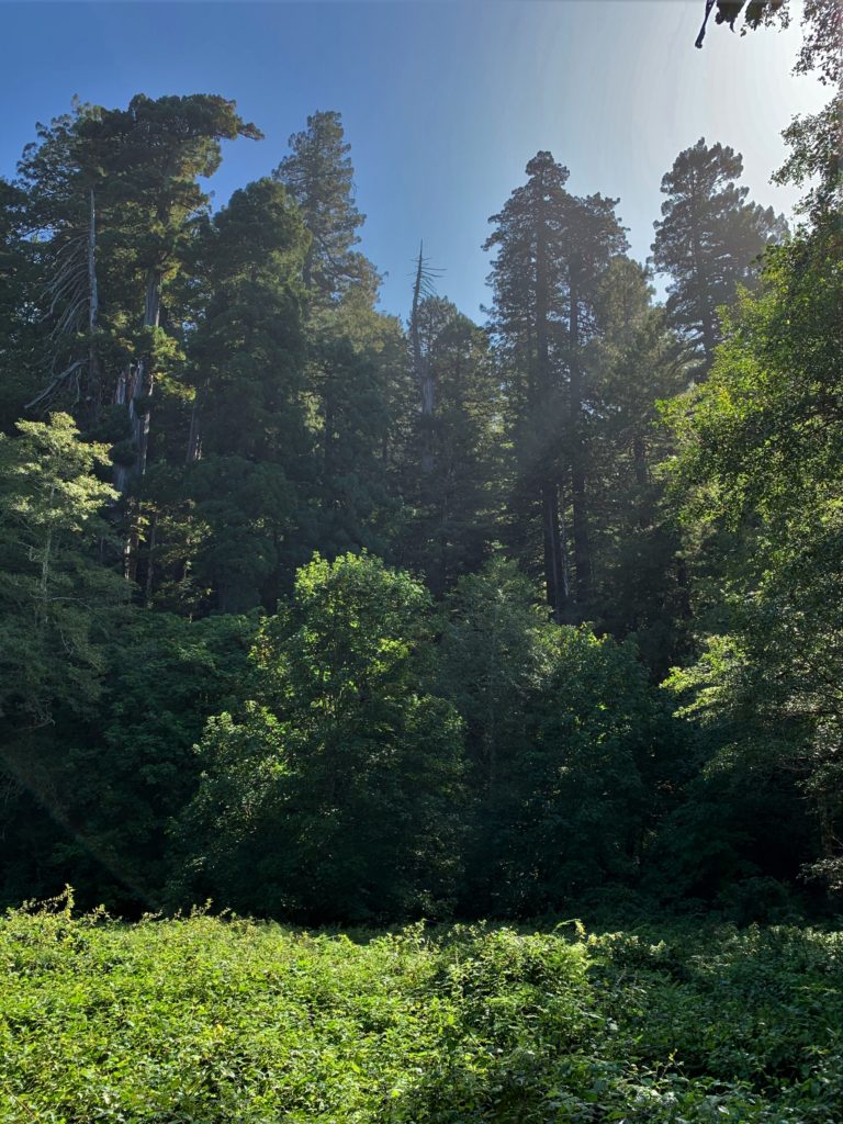
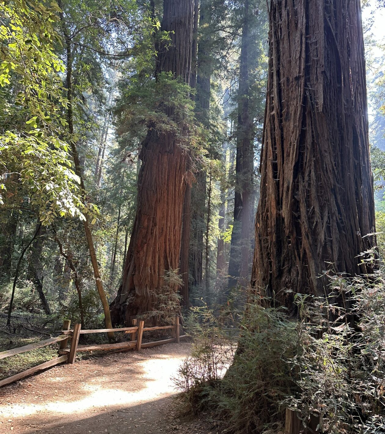
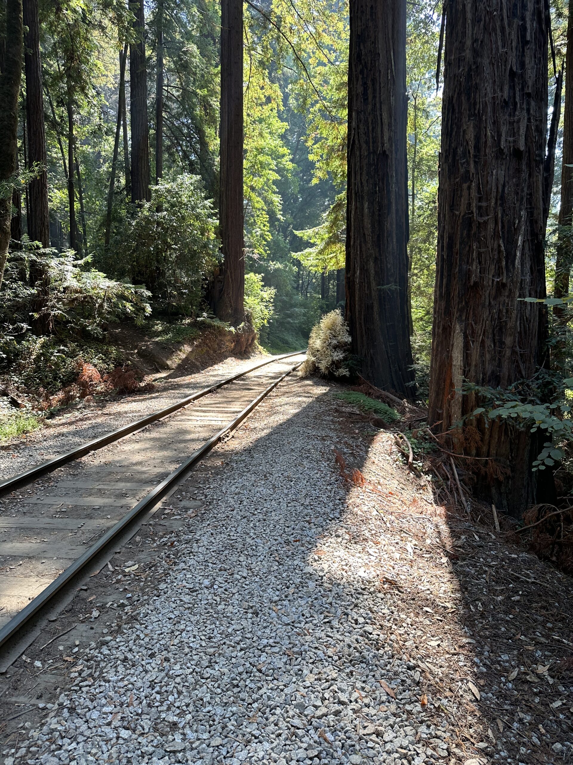
The drive on day five was very interesting, taking expressways through the South Bay area and then the winding roads to the Felton – Henry Cowell Redwoods State Park – Roaring Camp area.  Henry Cowell Redwoods are beautiful, on a flat right above the San Lorenzo River.  There are many really big redwoods along the primary old growth trail.  This park has really nice facilities and a big parking lot near the trail entrance to handle a good number of visitors.

Later that afternoon I drove over to the Aptos Creek area to visit Ed (the Redwood Ed) and we took a nice walk and saw some big redwoods along Aptos Creek, very close to the Pacific Ocean.

I enjoyed my time in the redwood areas and meeting up with some good people. Thanks for reading.

Easy and Scenic Redwoods Hiking – The Great Northern Redwood Parks From South to North

1      Hendy Woods

 Hendy Woods is about 125 miles north of San Francisco.  Do a rest stop in Cloverdale, the driving west on Route 128 is windy and slow for a while, but then things level out when the scenic Anderson Valley is reached.  Hendy Woods is small but has some big and tall redwoods, a few above 340 feet in height.  The loop trails are easy level hiking.

Hendy Woods from Navarro River
Hendy Woods upper loop trail

2      Montgomery Woods Reserve

Montgomery Woods is 30 winding miles north of Hendy Woods.  This is a pretty famous redwood park.  It has a couple trees that are in the top 20 in height among all redwoods.  There is a short hike from the parking lot to the grove that has a pretty good elevation change but is very doable if a measured pace is followed.  The trail is very nice, looping around both sides of the grove and allowing hikers to walk right among the tall trees.

Montgomery Woods Reserve natural earthen dam
Montgomery Woods upper flat

3      Richardson Grove

Richardson Grove is about 100 miles north of Montgomery Woods.  The short drive through this grove along 101 is spectacular.  Slow down and enjoy it.  The tallest redwoods in the park are at the visitor center and are about 340 feet in height, but there are a bunch of big and tall redwoods right along 101.

Richardson Grove visitor center deck trees
Richardson Grove tall redwoods at visitor center

4      Humboldt Redwoods

The heart of Humboldt Redwoods is about 40 miles north of Richardson Grove.  The Founders Grove and nearby Rockefeller Loop have very nice mostly level trails, with a number of trees over 360 feet tall. 

Humboldt Redwoods chaos at Dyerville Giant
Humboldt Redwoods Rockefeller Loop

5      Redwood National Park

Redwood National Park is about 100 miles north of Humboldt Redwoods.  The tallest trees in the world grow in the remote Redwood Creek Valley and are 380 feet tall.   However if you want to drive deep into a big redwood forest with easy hiking do the Lost Man Trail.  There are big trees in Lost Man as well as a few over 350 feet tall. Another good Redwood National Park trail near Klamath is up Flint Ridge, it is well constructed and the climb is scenic and gradual.

Redwood National Park Lost Man Trail
Redwood National Park Flint Ridge

6      Prairie Creek Redwoods State Park

Prairie Creek Redwoods is just north of Redwood National Park and has many trails through fine redwood forests.  The great trail network starts at the visitor center and there are also a lot of trails accessible along Drury Parkway and Cal Barrel Road. Lots of the largest (by volume) redwood trees are in Prairie Creek.  The trails near Prairie Creek are relatively flat and then there are some trails going up the hillsides that have nice gradual ascents.

Prairie Creek Redwoods near visitor center
Prairie Creek Redwoods Irvine Trail

7      Del Norte Redwoods State Park

The heart of Del Norte Redwoods is about 20 miles north of Prairie Creek Redwoods.  There are few trails and they are pretty steep.  The section of the Damnation Creek trail from 101 to the old Coastal Highway is steep but not very long, the climb out is not a problem.  The old Coastal trail at the Damnation creek intersection is very scenic and follows the outline of a big canyon.

Del Norte Redwoods Coastal Trail

8      Jedediah Smith Redwoods State Park

Jedediah Smith Redwoods is about 15 miles north of Del Norte Redwoods.  The Boy Scout trail goes from the east to west end of the park.  It has a couple small hills and is about a five mile hike out and back.  It is well worth the time and effort, don’t make a race of it and keep your eyes open for many big redwoods, some right along the trail.

Jedediah Smith Redwoods Boy Scout trail eastern section
Jedediah Smith Redwoods Boy Scout trail western section
Jedediah Smith Redwoods Boy Scout trail western end

Thanks for reading.

Redwood Creek Symphony

Redwood Creek Symphony – Opus 381 – Allegretto

As Inspired by Beethoven’s Seventh Symphony, Second Movement (Allegretto), “Knowing”.

For more photos and associated music in You Tube, please go here

Movement 1 – il fiurne icontra l’oceano (River Meets Ocean)

Redwood Creek flows into the Pacific Ocean just south of Orick, California.  The outflow area includes some rocky headlands, pastures, and a large earthen levy.  The levy is to mitigate the effect of offshore earthquake induced tidal waves.   Not too long ago, and for thousands of years before that, native peoples used this area in the winter for fishing and hunting, with their villages located a few miles upstream in sunnier and warmer areas near Emerald Creek (a feeder creek to Redwood Creek).   The native peoples also used the Bald Hills area in the summer and fall for hunting and collecting acorns.  The Emerald Ridge, Dolason, and Tall Trees trails are likely routes originally used by the native peoples to travel between the Bald Hills and Redwood Creek.

There is a good reference created in 1914 that included interviews with older Chilula peoples who lived along Redwood Creek before mid 19th century conflicts with settlers led to many deaths and resettlement of the survivors to the Hoopa Reservation: https://digitalassets.lib.berkeley.edu/anthpubs/ucb/text/ucp010-007.pdf

One way to access this area is a pleasant beach walk from the Kuchel Visitor center.  It is a lot safer and warmer to walk near the high tide line versus in the surf, as the water is cold and sneaker waves can knock a person down and drag them out into the ocean.

This is an area where the steady outflow of Redwood Creek can be expressed by soft string music, then the waves are represented by the thump of the kettle drum, and the sadness of what was lost through minor scales played by oboes and clarinets, particularly the first wailing call at the start of the movement.

This movement covers Redwood Creek from the ocean to the turn southward, and the first one minute forty five seconds of Beethoven’s allegretto.

Redwood Creek outflow to Pacific Ocean
Beach near Redwood Creek outflow to Pacific Ocean

Movement 2 – inizia la grande foresta (The Great Forest Starts)

Moving upstream Redwood Creek turns south, winding around the base of Orick Hill. It is in this area the great Redwood Creek forest starts.  Here the trees are not quite as tall as further upstream, as sunlight is suppressed by coastal fog for much of the year.   Yet the tallest trees in this area approach 330 feet in height. There are open fields on the east side of the creek, through fire maintenance by native peoples and now the National Park Service.  Elk are in this area, and there is still a hint of the Pacific Ocean as evidenced by large Sitka spruce trees in places near the creek.  Big mossy maples are also around, giving a hint to past flooding events.

This area is a transition zone between the maritime area and the tallest trees which are further upstream.

In this movement there is a building, repeated melody played in the string section.  It is a hint of what is to come, as the tall trees are all round and become more numerous moving upstream.  This would cover about 1:45 to 2:45 in Beethoven’s piece.

Orick Hill north end scene created from LiDAR point cloud
Looking southwest along Redwood Creek in the north Orick Hill area
Sitka spruce along north portion of Redwood Creek trail

Movement 3 – la foresta che tocca il cielo (The Forest That Touches the Sky)

Starting immediately around the area of the north seasonal foot bridge, the tree height skyrockets.  Here is the start of a six mile sweet spot, with nightly fog providing year round moisture for leaves through absorption and for roots through fog drip.  But then the fog retreats during the day and allows the sunshine to provide energy for photosynthesis. There are many side streams with gulches and gullies, where the tall trees can find wind protection.   The hillsides give a push to the water column of each tree, as water first flows downhill a few feet from the uphill side of the trunk to give a boost to the osmotic pressure that brings that water up through the xylem to the crown.  There are also flats near Redwood Creek with very rich soil.  The tall redwoods grow all over, on the hills above Redwood Creek, up the side streams, and on the flats.  Only the trees on the flats can be accessed safely, Tall Trees Grove year round, then the other flats only when Redwood Creek is running low.  It is exceedingly dangerous hiking off trail along the hillsides and creeks above Redwood Creek and its side streams.

 In this area there are perhaps 35 trees above 350 feet in height.  Before the area timber harvest started in 1950 there were probably four times as many (about 140).  How tall was the tallest, was it taller than 380 feet?  We’ll never know for sure, and it is very special there are a couple trees around 380 feet in height, still.  There is an excellent article on historic tall Douglas firs and Coast redwoods by Micah Ewers, it is here:

In this movement the full orchestra pitches in on the main melody, playing loudly, with the beat kept by a thumping kettle drum.  Each beat of the drum represents a 350 foot tree, and each note in the melody signifies the magnificence of the forest.  There are also some intervening sections with soft undertones by the woodwinds that signify what was economically gained and then lost as the timber was harvested from 1950 to 1977. 

This movement covers about 2:45 to 7:05 in Beethoven’s opus.

Redwood Creek near north seasonal foot bridge
Redwood Creek trail east slope near northern seasonal foot bridge
Flat at 44 Creek as viewed from the south
Tall Tree Groves north side as viewed from the northwest
Above Redwood Creek tributary

Movement 4 – magnificenza sopra il torrente (Magnificence Above the Stream)

Starting around the Emerald Creek inflow, Redwood Creek becomes more stream like and a lot of the forest above the creek is second growth.  But old growth remains, with a few trees here and there trying to touch 350 feet.  The nightly fog inflow starts to dissipate in this area, and the forest becomes drier, especially in the summer.  This is a hard to reach area with some scenic spots, I have been told.

This movement is carried by woodwinds and the strings are plucked at times, representing resignation that the forest is dwindling and losing height.  But every now and then the orchestra chimes in with a new short bright melody, like a scenic early evening sky, representing the occasional towering trees that occur in this area.  It is still very good.  Then at the very end the main melody returns, for a few short notes.  This represents the end of the old growth.

In Beethoven’s opus this runs from about 7:05 through to the end at 9:10.

View to the south of Tall Trees Grove along Redwood Creek

Thanks for reading.

Redwood Thunder

1      Redwood Thunder

Redwood thunder is an uncommon but not rare event. It occurs when a large redwood tree falls to the forest floor, sometimes striking and taking other redwoods, firs, spruce, oaks, and maples with it. A cubic foot of redwood weighs 50 pounds, so if a moderately large 20,000 cubic foot redwood topples that is a million pounds, or 500 tons of wood crashing to the earth.

For redwood thunder to occur usually soaked soil and wind are required, though if the tree fractures on itself soaked soil is not an ingredient.  Sometimes before redwood thunder occurs the tree will lean against an adjacent tree, with the trunks and branches rubbing with the wind and making screeching sounds like giant stringed instruments.

All redwood trees eventually topple, or at least break off down to a low point on the trunk.  If a given old growth redwood has a one in a thousand chance of falling in any given year than that means, based on acres of old growth redwoods, the average annual tree fall count in the large redwood parks is about 300 trees, per park.

If there are multiple trees involved in a tree fall or if the tree falls across a creek, the tree fall is noticeable in Google Earth.  If you hike the same trails over several years you will for sure see trees that have recently fallen.  Their upper trunks are huge and their logs run sometimes more than a football field along the forest floor.

`

2      Examples of Tree Falls


Here are several examples of tree falls I ran across in 2016.  Included are a picture I took of the tree fall accompanied by before and after Google Earth views of the tree fall areas (using Google Earth historical imagery).

In Humboldt redwoods a neighbor of the big Dyerville Giant log fell in the late spring 2016.  Its trunk shattered and splintered into sections where it struck the Dyerville Giant log.

Tree fall across Dyerville Giant in Founders Grove


Founders Grove - tree to fall marked with X. (Image from Google Earth)
Founders Grove – tree to fall marked with X. (Image from Google Earth)


Founders Grove - space left by fallen tree marked by X. (image from Google Earth)
Founders Grove – space left by fallen tree marked by X. (Image from Google Earth)


Another recent tree fall in Humboldt was in the area where a seasonal foot bridge is put in to link the Rockefeller Redwood area to the Giant Tree area on either side of Bull Creek in the upper Bull Creek Flats.  The new big log is used a lot to cross the creek, though it would be a pretty tough eight foot or so fall from the log to the rocky creek bottom if your foot or the bark slipped.

Log across Bull Creek in Giant Tree area


Bull Creek Giant Tree area - tree to fall marked with X. (Image from Google Earth)
Bull Creek Giant Tree area – tree to fall marked with X. (Image from Google Earth)


Bull Creek Giant Tree area, empty area where fallen tree was standing marked with X (Image from Google Earth)


A third fall in Humboldt occurred in Harper Flat.  The tall north side of a twin trunk redwood fell in the last couple years.

Harper Flat fallen tree, north side of pair (still from I Phone video)


Harper Flat - tree to fall marked with X (Image from Google Earth)
Harper Flat – tree to fall marked with X (Image from Google Earth)


Harper Flat - area left by fallen tree marked by X (Image from Google Earth)
Harper Flat – area left by fallen tree marked by X (Image from Google Earth)


The final example is in an area of tall hillside redwoods on the east side of Redwood Creek a little north of McArthur creek near the seasonal foot bridge.  Here the tree fall took out a number of redwoods and the whole group of fallen trees is slowly sliding down toward Redwood Creek.

Redwood Creek tree fall area, trees are slowly sliding downhill.


Redwood Creek hillside above north seasonal foot bridge, trees to fall marked with X (Image from Google Earth)
Redwood Creek east hillside above north seasonal foot bridge, trees to fall marked with X (Image from Google Earth)


Redwood Creek east hillside above north seasonal foot bridge, area where trees stood marked with X (Image from Google Earth)

3      What Can Be Learned From Fallen Redwoods


A recently fallen redwood is a great opportunity for whole tree research once the soil in the fall area has stabilized.   The root system and affixed soils can be studied without any digging, this is the big primary benefit.  But also core samples can be extracted without having to climb and core living trees.  The canopy structure can be measured and reviewed without climbing and an unlimited amount of destructive sampling can be done.

Thanks for reading.