A couple months ago (mid September 2023) I took a few days to visit the redwood parks and forests in Santa Cruz, Mendocino, and Humboldt counties in California. I also caught up with a few redwood colleagues, it was nice visiting and doing some walking and hiking.
Day One – Big Hendy and Little Hendy Groves in Hendy Redwoods State Park near Philo
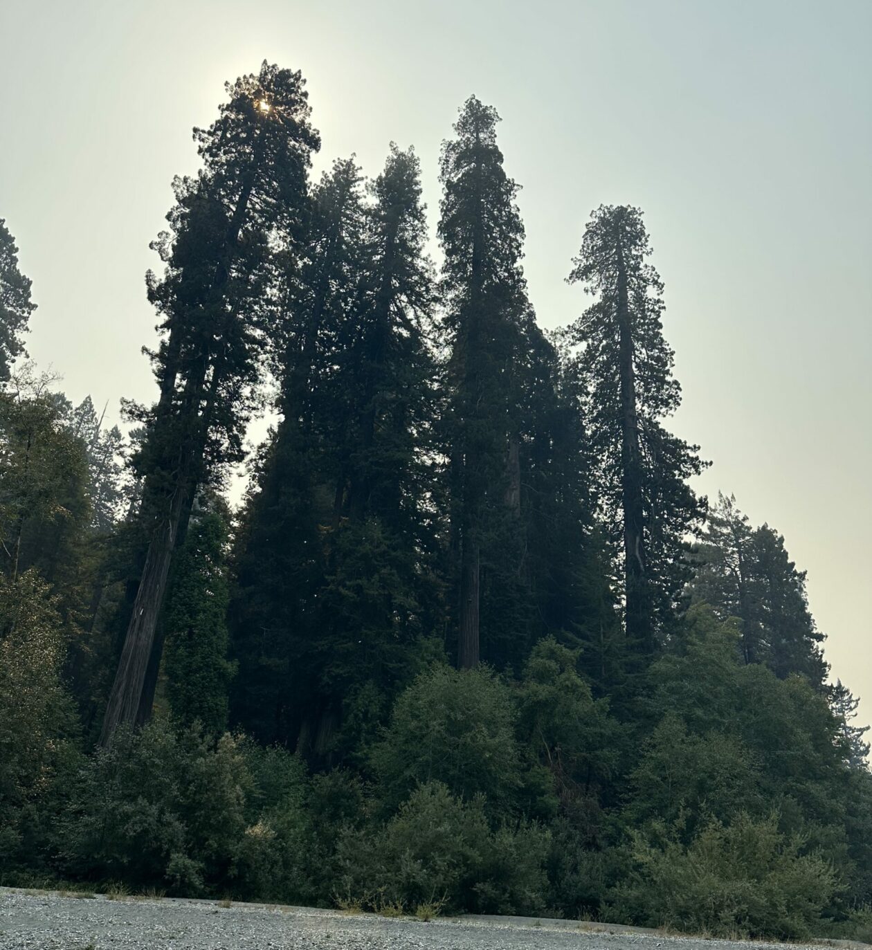
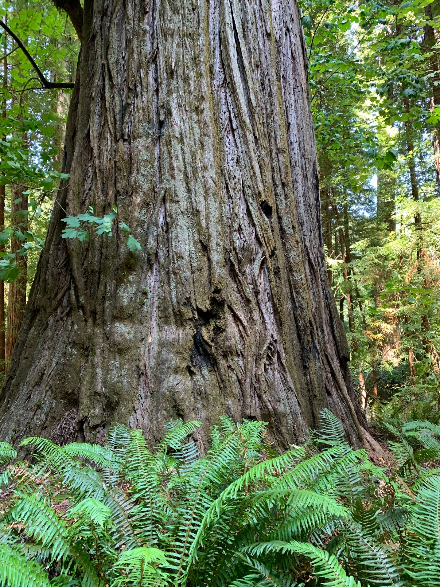
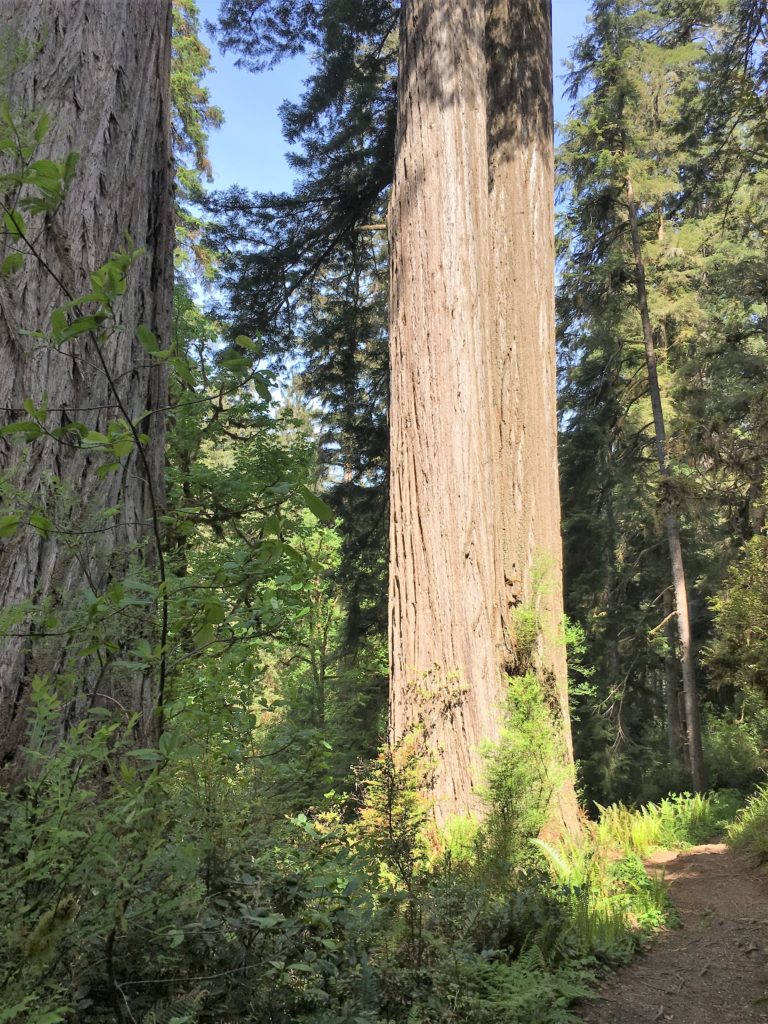
Big Hendy redwood grove has well maintained relatively flat trails that wind throughout the old growth area. There are tall trees here, with twenty or so from 330-350 feet in height. There is also a nice prairie area adjacent to the river and good picnic facilities.
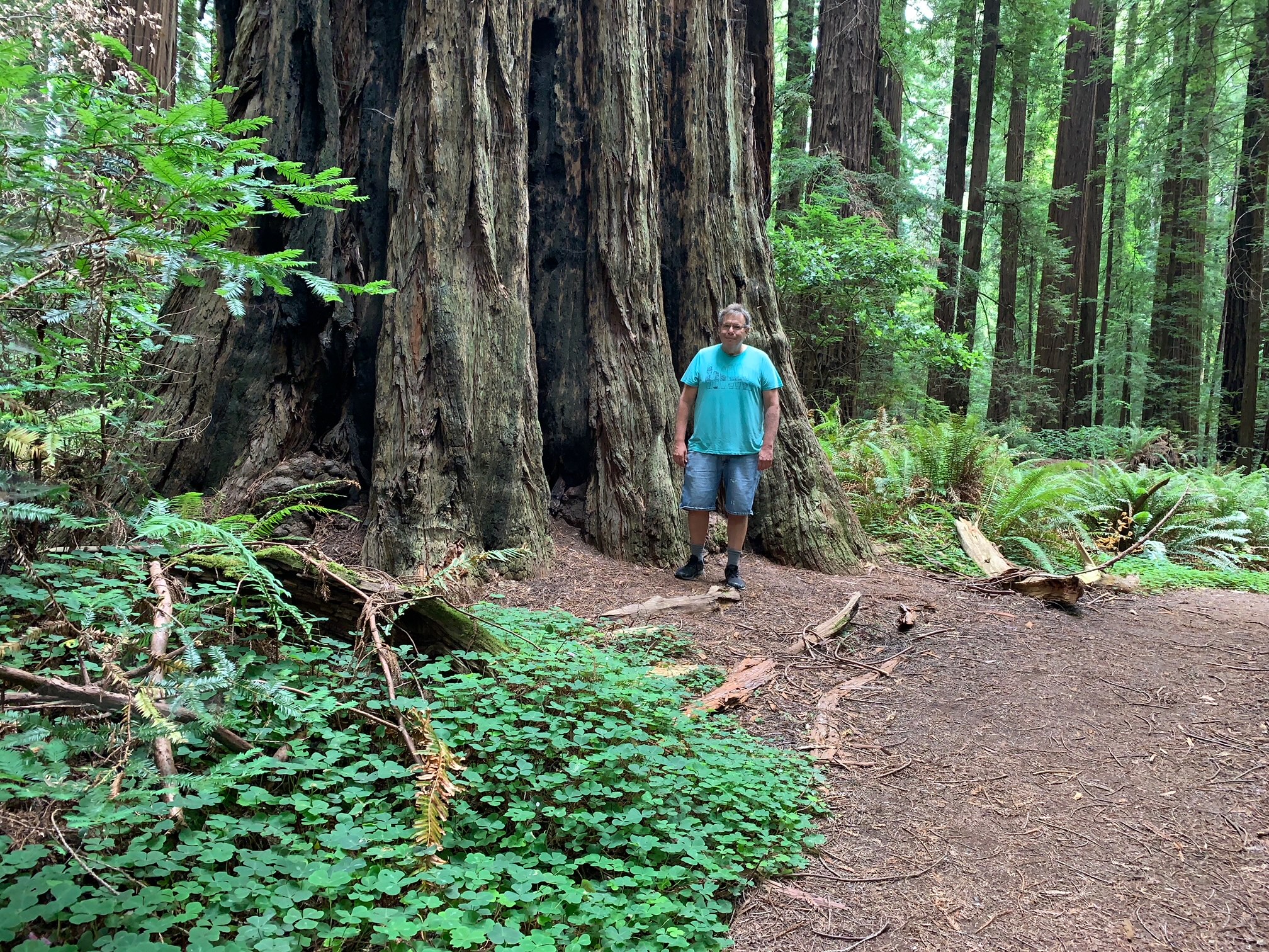
Little Hendy redwood grove is a smaller though just as nice grove closer to the visitor center and is pretty much right above the banks of the Navarro River. The primary trail is a single narrow oval loop with small elevation changes. There are some large and unusual redwoods in Little Hendy Grove right along the loop.
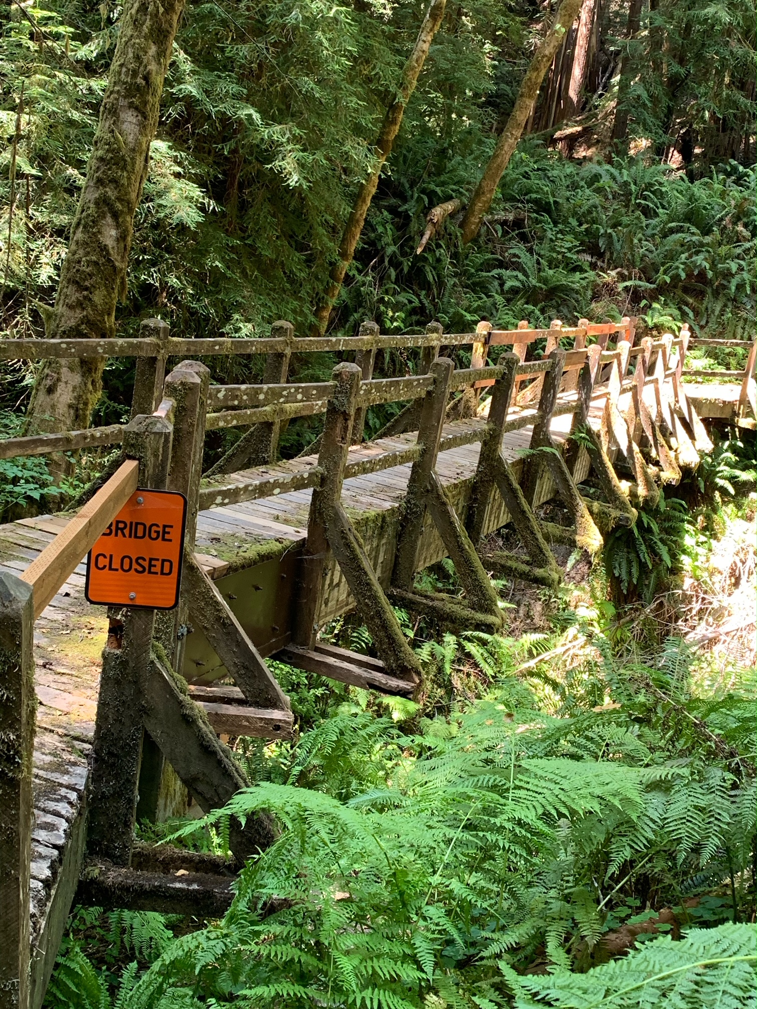
Bridges cross small ravines (which can be wet in the winter) along Big Hendy Loop trailA fine redwood near the Big Hendy Loop trailBig Hendy loop trailLittle Hendy loop trail
Day Two – Humboldt Redwoods State Park Bull Creek Groves
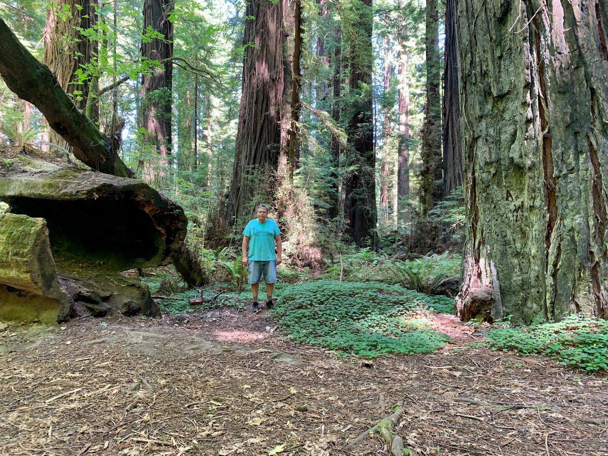
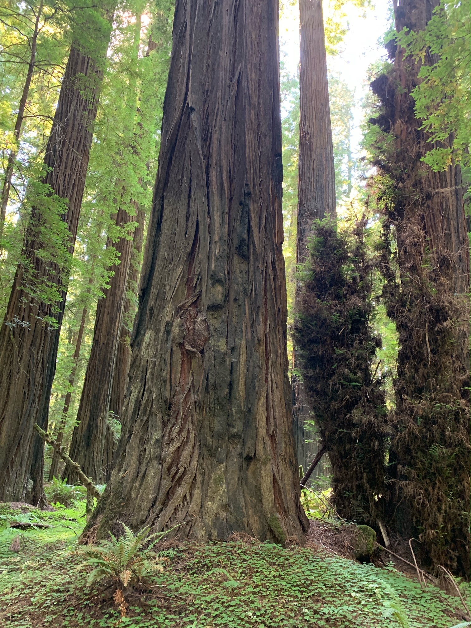
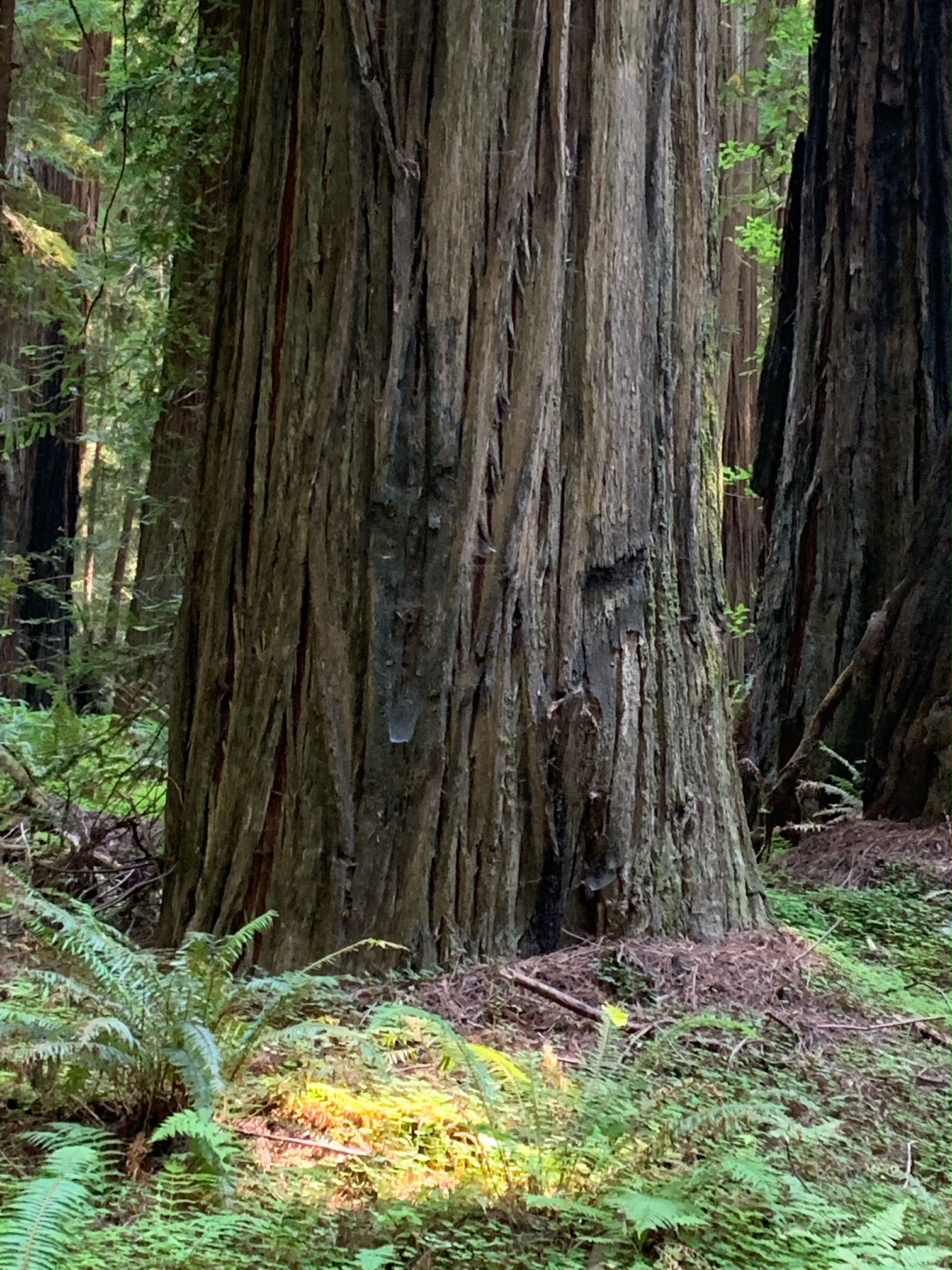
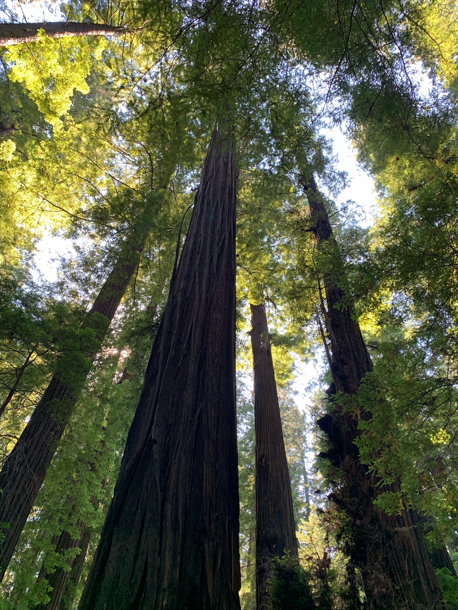
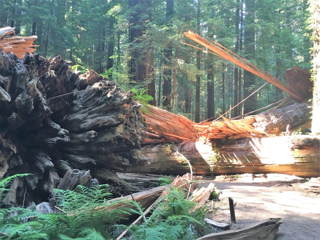
I met John (the Eagles fan John) in the Tall – Giant tree area off Mattole Road. We did some hiking in the flats on both sides of Bull Creek. There were a few downed trees, especially on the north side of Bull Creek. The Giant Tree dropped a big limb or two recently, smashing through the deck surrounding it and destroying the sign beside the deck. There is also a big deep hole in the ground on the west side of the Giant Tree, obviously involving the Giant Tree’s roots. It is worrisome.
The drive along Mattole Road took me though the area where there was a big landslide last Spring. About a quarter mile of the road is now gravel track, and there are many downed redwoods on the downhill side of Mattole Road through this area.
The Giant Tree deck and sign got whacked in the last year by large falling branches.This redwood has been surroundedBull Creek north end trail a little east of the Tall Tree parking area. This redwood fell in the last year.
Day Three – Redwoods National Park Tall Trees Grove
I really enjoy the drive and hike to Tall Trees Grove, and the grove itself is great. In the summer walking out onto the gravel bars of Redwood Creek from the Tall Trees trail is a must to see the giants in profile. These redwoods are huge living things.
There was a lot of tree fall along upper Tall Trees grove trail last winter and many well executed repairs are visible on the upper part of the trail. Down in the grove itself all the giants seem to be standing tall. I spent a lot of time on the gravel bars taking in the views, both immediate and long distant. The hike back up the steep hill is a good leg and lung stretcher and I enjoyed respites on a couple of well positioned benches.
These signs are up in the Tall Trees area. The Tom McDonald creek area is off limits, with severe penalties for entering the area.The Tall Tree in Tall Trees Grove loop. Still a very tall redwood.This big redwood on the Tall Trees loop fell five years ago – when upright it was called the Deadwood Giant. Redwood Creek gravel bar looking south. Many tall redwoods both near and distant are in view.A nice grouping of redwoods in the Talls Trees Grove. These trees are in the 100-100 club (over 100 meters height, over 100 Mg mass).
Day Four – Humboldt Redwoods Pepperwood Area, Smithe River State Natural Reserve, and Chamberlain Creek Waterfall Trail in Jackson State Forest Mendocino County
On day four I met Steve (the Cal Poly Humboldt Steve) and we did some hiking and work in the Pepperwood Area of Humboldt Redwoods State Park. Most of the time we were in French Bell Grove, but we also went over to the north end of the Avenue to check out a few trees close to 101.
Later that day I finally stopped at Smithe Redwoods State Natural Reserve along 101 north of Leggett. Care needs to be taken exiting and entering 101 from the adjacent parking area as this is a high-speed curvy area of the highway. Smithe Redwoods are on a nice flat above the Eel River and there is some impressive old growth there. A couple trees top out at 330 feet.
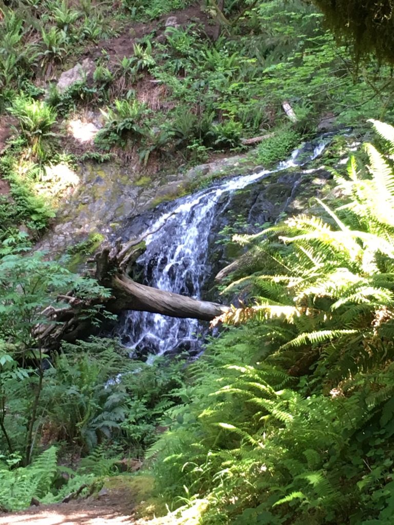
After this it was off to Chamberlain Creek Waterfall Trail between Willits and Fort Bragg in Jackson State Demonstration Forest in Mendocino County. This area is a little remote and has gravel roads on the approach and it is good to have well researched written directions when driving there. The trail is great, it starts from a road and moves sharply downhill into a creek valley filled with tall old growth redwoods. The waterfall was flowing, and the wide cascade drops straight down a twelve foot or so wall of rock. The waterfall and redwoods are in the same immediate area, so the vista is scenic and tranquil.
Big trunk and crown of large redwood in Grieg-French-Bell groveTallest redwood in the Pepperwood area, well over 350 feet and surrounded by poison ivy.Some of the Smithe Redwoods are along 101 and can be approached from below. Avoid the road berm.Steps leading down to Chamberlain Waterfall trail from gravel roadTall old growth along Chamberlain Creek. Some trees are over 340 feet tall.Chamberlain Creek Waterfall
Day Five – Henry Cowell Redwoods State Park and Aptos Creek in Santa Cruz County
The drive on day five was very interesting, taking expressways through the South Bay area and then the winding roads to the Felton – Henry Cowell Redwoods State Park – Roaring Camp area. Henry Cowell Redwoods are beautiful, on a flat right above the San Lorenzo River. There are many really big redwoods along the primary old growth trail. This park has really nice facilities and a big parking lot near the trail entrance to handle a good number of visitors.
Later that afternoon I drove over to the Aptos Creek area to visit Ed (the Redwood Ed) and we took a nice walk and saw some big redwoods along Aptos Creek, very close to the Pacific Ocean.
Large redwoods along the loop trail in Henry Cowell redwoodsLarge tree in Henry Cowell Redwoods, 280 feet tall and 1,500 years oldRedwoods along rail line in Roaring Camp area
I enjoyed my time in the redwood areas and meeting up with some good people. Thanks for reading.
After a three year break, I got back to the redwoods in late July 2022. I am thankful for the gifts of health, time, and family that allowed me to make this trip.
Day One – Richardson Grove State Park and FK Lane Grove in Humboldt Redwoods State Park
My early morning flight to San Francisco was on time and that, along with the still long summer daylight in late July, gave me a good amount of time to do some short redwood hikes on my way up to Arcata.
First stop was Richardson Grove State Park, and I told the person collecting daily fees at the entrance booth I was very glad to get out of the car and do a little bit of hiking. This State Park has about 25 acres of old growth redwoods with heights up to 345 feet and is very well trailed. US Route 101 runs right through the old growth as a two lane, heavily trafficked, relatively low speed limit road. Some of the park roads go under 101 to allow full access to all areas of the park.
I did a little bit of walking in the area adjoining the South Fork Eel River and was surprised to see a rattlesnake awareness sign in an open rocky area. I didn’t note any of the snakes that afternoon. The swimming holes on the river were being well utilized on the 95 degree afternoon.
I went over to the original visitor center with its relatively well known “deck” and “outhouse” trees which were incorporated into the building’s footprint. I measured the “deck” tree at 103 meters, I likely didn’t get the tippy top. From the visitor center area there are well maintained paths lined with short fences that go through the old growth areas. They really want you to stay on the trails here, as the old growth area is concentrated and decently trailed. I did wander off just a little bit to get a picture of one of the tallest trees in the park, which sits right beside the highway.
Tall tree grouping around the visitor centerRail lined trails, pretty fancyNice redwood on the east side of US 101
After this stop it was back on 101 North to the Avenue of the Giants and the FK Lane Grove, just north of Phillipsville. This grove sits on the east side of the Avenue of Giants and is about 35 acres. It has one main trail and a well tracked unofficial trail. There are big redwood trees in this grove, and some are also over 350 feet tall. These are the first 350 foot trees found north of Montgomery Woods SNR. The hike through the grove was nice but hot in the late afternoon, with the air being very still. I could hear people swimming in the Eel River South Fork even though it is about 600 yards to the west.
FK Lane tall tree near south end of trailFK Lane big tree near trail at north endFK Lane upper trunk and crown big tree near trail at north end
After this hike it was on to the very nice Miranda Market for some gas, food, and drinks, and then on to Arcata.
Day Two – Redwood National Park
For this hiking day I met up with John H, Marie, and Steve to do the hike from Emerald Ridge Trail to Tall Trees Grove to 44 Creek, returning to the parking area via Tall Trees Grove Trail. This was close to an all day hike and involved a lot of creek wading. Switching to hard soled water shoes for the wet parts makes travel a lot easier. Hiking in Redwood Creek is only possible during the dry season – the creek is too fast and deep to hike most of the year.
The Emerald Ridge trail descent to Redwood Creek included a side trip to the scenic bridge crossing over Emerald Creek on the Dolason Prairie Trail. One downer was to see so many browned Tan Oaks, SOD (Sudden Oak Death) has really moved into the area.
Large chinquapin along Emerald Ridge TrailEmerald Creek from Dolason Prairie Trail bridgeRedwood Creek at end of the Emerald Ridge Trail
A lot of the forest between the Emerald Ridge trail endpoint and Tall Trees Grove has been cut, but there is a nice grove on what is called Emerald Flat, including a 360 foot tall tree. We went a short way into Emerald Flat to see this tall tree and a few others. There is a lot of bear sign on the flat, and they have chewed the cambium layer off some of the younger trees. Some of the trees near the creek also have flood marks, showing Redwood Creek enters the flat when the water gets very high.
Emerald Flat along Redwood CreekBig trees on Emerald FlatTallest tree on Emerald Flat
Redwood Creek is warm in late July, and other than a few ripples it was not too difficult moving through the dry season two foot deep water. This route is definitely a no go most of the year. The creek bottom is cobblestone lined so you need to let your steps kind of slide into gaps to maintain good traction over the slippery stones. At one point in the hike, we were near the mouth of Tom McDonald Creek and that creek’s outflow was much, much cooler. We didn’t hike in Tom McDonald creek.
Bear damage to young redwoodsAlong Redwood Creek south of Tall Trees GroveAbove Redwood Creek south of Tall Trees Grove
Coming up to Tall Trees Grove from the south is spectacular. This flat has is aptly named, with six or so trees over 350 feet tall. There are about three dozen over 328 feet tall (100 meters). We moved over to the Redwood Creek Trail and hiked up to the 44 Creek Bridge area. After that back to Tall Trees Grove and the loop trail there, then up the steep hill to the parking lot. There were two noticeable changes in Tall Trees Grove since I was there in 2018 – a tree named the Deadwood Giant fell and the large multi branched big leaf maple along the loop fractured into many pieces. Also, there are new signs up showing the Hyperion Tree closure area. It includes a lot of Tom McDonald creek and the hillside between Tall Trees Grove and Hyperion. Too many visitors to that tree.
Tall Trees Grove north end from Redwood Creek44 Creek Bridge on Redwood Creek Trail – officially closedLooking over to 44 Flat and the growing top of one of the twenty tallest trees in the worldDeadwood Giant fallen across Tall Trees Grove loop trailHyperion area closure sign at start of Tall Trees Grove loop trailBig and tall redwood near the north end of the Tall Trees Grove loop trail
Day Three – Cheatham Grove and Humboldt Redwoods State Park
On the morning of day three I drove over to the Cheatham Grove at the west end of Grizzly Creek Redwoods State Park along the Van Duzen River. This is a really pretty grove and the trail is well laid out, with some benches at the best spots to soak in the atmosphere. The grove covers about 100 acres and has about a half dozen trees 340-350 feet in height. Taking the trail to the right from the parking lot will shortly lead you to the Cheatham Giant on the left side of the trail. This is a really spectacular tree. In addition to the redwoods there’s also a beautiful big leaf maple that forms a large circular green domed canopy. You can also walk out to the scenic Van Duzen River from the trail to get expansive views of the tall redwoods.
Big tree in Cheatham Grove. Taken with tripod mounted I Phone.Maple dome in Cheatham GroveNice trailside tree in the Cheatham Grove
After this hike I drove to the north end of the Avenue of the Giants and hiked along a long abandoned section of the old Redwoods Highway. This is the area of tall redwoods seen from the US 101 scenic point overlook north of Humboldt Redwoods State Park. There are about 15 trees over 330 feet tall in this 75 acre area also known as Elinor, with heights topping out at 355 feet.
Avenue of Giants north end in center rightLarge and tall redwoods in Elinor areaOn the old highway in the Elinor area. Maximum self portrait distance for 10 second timer!
After the walk on the old highway, I drove southeast on the Avenue of the Giants to the Holmes Flat area, which is a 50 acre old growth area just west of the Ancient Redwoods RV Park Gift Shop. There aren’t any official trails and care must be taken if walking near or along the Avenue. There are a half dozen trees over 330 feet in the Edmonson and Haas groves on Holmes Flat, with the tallest topping out at 350 feet.
Holmes Flat power lines and treesHolmes Flat RedwoodHolmes Flat adjacent to Avenue of the Giants
From Holmes Flat, I drove south on the Avenue to the High Rock area and hiked the north and central portions of the High Rock trail. The High Rock old growth area comprises 75 acres above the Eel River and below the Avenue of the Giants. There are 30 trees over 328 feet tall, with maximum height around 350 feet. Just north of High Rock itself the trail dips down to the Eel River to an area that has public vehicle access and river swimming. Some of the trees closest to the riverbank show flood deposits on their trunks even though they are 30 feet above the normal river elevation. This shows the extent of the big flood in December 1964.
Big tree along High Rock trailHigh Rock as seen from Eel RiverTall trees 30 feet above Eel River in High Rock area showing water marks from 1964 flood
A last, but not small, stop in the late afternoon was Founders Grove. It was pretty busy at the Dyerville Loop Road intersection with the Avenue of the Giants. A large tour bus was trying to park along Dyerville Loop road where it goes through Founders Grove while at the same time a convoy of three logging trucks, loaded with tree trunks, was using Dyerville Loop Road to access US 101 just west of the Avenue of the Giants and was traveling through Founders Grove at the same time. It took about fifteen minutes for things to get sorted out.
I wound up parking along Dyerville Loop Road at the northeast edge of Founders Grove, and then did some walking through the roadside groves. After this walk I drove over to the Avenue of the Giants and went south a short distance, then parked on the west edge of Founders Grove. I then did some walking on trails on both sides of the Avenue, admiring the big and tall trees in this area of Founders Grove.
Founders Grove covers about 260 acres, with 220 trees over 328 feet (100 meters) tall. About 40 of these trees are between 350 and 363 feet tall. All the trails are on the west side of Founders Grove, and the east side of Founders Grove is one of the largest roadless, untrailed tall old growth redwood areas, about 100 acres.
Northeast side of Founders Grove, an interesting tree base.Founders Grove near the riverFounders Grove near the Avenue of the GiantsFounders Grove near the Avenue of the GiantsWest side Founders Grove crownsMore west side Founders Grove crowns
Day Four – Humboldt Redwoods State Park and Eureka
Today was for some focused activity near Mattole Road in Humboldt Redwoods State Park. Working with a couple researchers, several mapping products and measuring methods were informally tested against new data sources created by instruments orbiting the Earth. An interesting blend of traditional and new technology was tested.
Nice morning light in the Mattole Road areaA big big tree in the Mattole Road areaMattole Road area – lots of elbow room for this redwood.
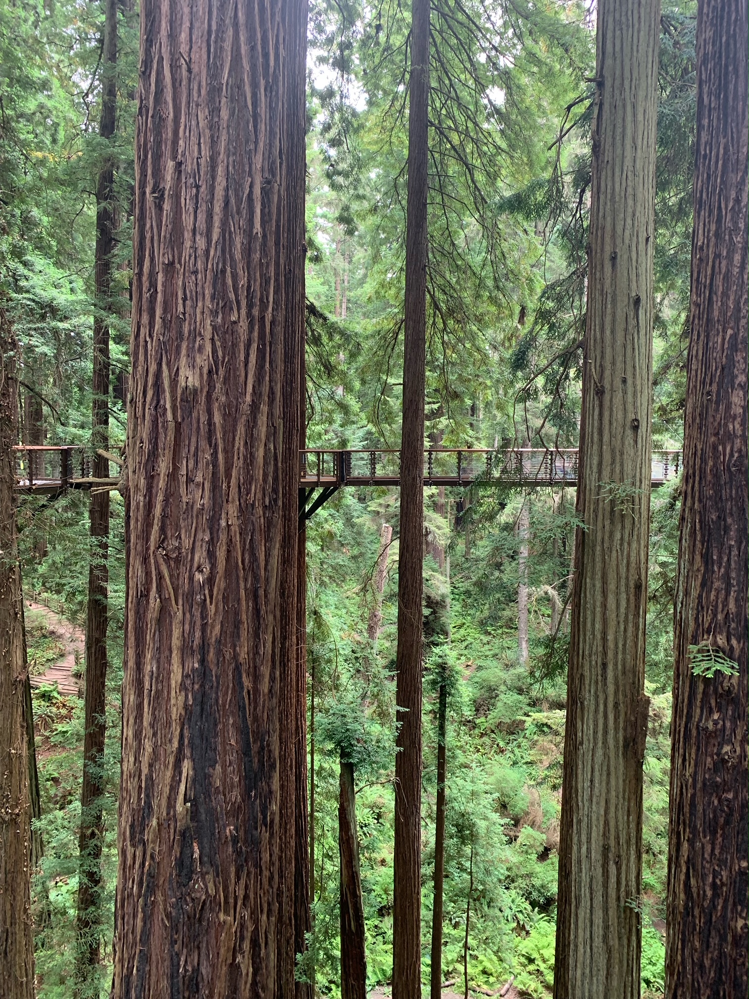
Later in the day I went over to the Sequoia Park Zoo and did their redwood canopy walk, it’s very nice.
Eureka Sequoia Park Zoo Redwood SkywalkLooking down from Sequoia Park Zoo Redwood Skywalk
Day Five – Humboldt Redwoods State Park
This was a day to hike through some more areas in Humboldt Redwoods State Park. I first hiked the trails south of the Founders Grove parking lot. It was still foggy when I started out but by mid-morning the sun was out, lighting up the trunks and canopies. The fallen Dyerville Giant is impressive. At the time it fell in 1991, at 372 feet tall it was likely one of the three tallest redwood trees (Hyperion was likely 377 feet tall in 1991).
At one time the Founders Tree was thought to be the tallest known redwood. It has lost about 30 feet in height over the last 60 years, and now at 335 feet is about #135 in height in Founders Grove and about #1,320 in height among all redwoods.
Founders Tree. Very nice but now 335 feet tall, kind of average for Founders Grove. Dyerville Giant, a titan that fell in 1991.Typical big and tall trailside tree in Founders GroveThe tall canopy in Founders Grove. There’s lots more than this !
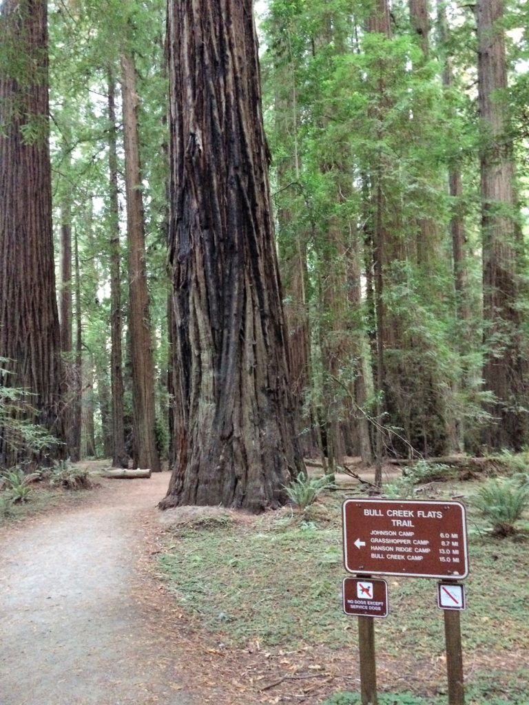
After Founders Grove, I headed over to the lower Bull Creek area. I hiked the Rockefeller Loop and followed the Bull Creek north side trail west for a bit. The Rockefeller Loop itself is 80 acres of old growth redwood, with about 120 trees over 328 feet (100 meters), Of these, 15 are over 350 feet tall, with a maximum height of 370 or so feet.
Rockefeller Loop northeast sideRockefeller Loop northeast side tall crownsRockefeller Loop south side by trail, a much photographed tall tree
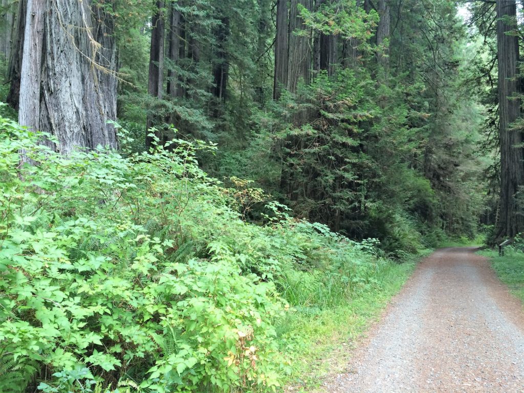
Continuing on the Bull Creek north trail there are some nice groves, even before reaching Calf Flat. Notably there is a tall, brilliant cluster of redwoods on the first flat west, then a scenic grouping of redwoods surrounding a clearing which was a staging area for some Bull Creek rehabilitation work in the 1950’s and 1960’s.
Nice trailside redwood Bull Creek northTall redwood cluster as seen from Bull Creek North trail. Tallest tree is back middle trunk.Open redwood grouping just off Bull Creek north trail
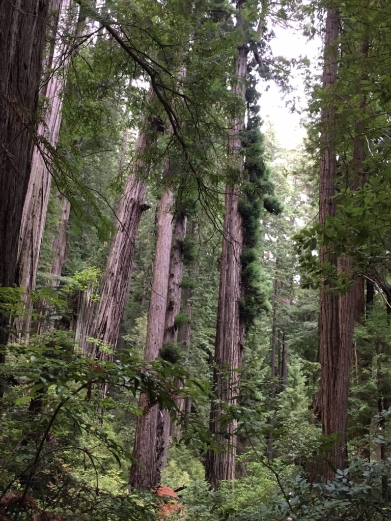
Next stop was the Tall Tree area toward the western end of the Bull Creek old growth. I hiked the Bull Creek trail east a ways, and the Big Trees Trail west a ways. There are many large trail side redwood trees. This area was relatively crowded, with people enjoying both the redwood trails and wading in Bull Creek.
A big tree on Big Trees TrailTall Tree, also known as Rockefeller Redwood. Now 367 feet tall, about #15 tallest.This is a nice group of redwood trees just east of Tall Tree. They’re also pretty tall !
That afternoon I also went over to the very west end of the Bull Creek old growth near Mattole Road bridge. There is a tall tree in that area named Lone Fern I’ve been trying to find without success. Anyhow this time I went down through the berry bushes at the bridge and tried to find a tall top with a range finder, but with no success. Anyhow, it’s in a nice grove right on the trail near the west end parking lot.
Bull Creek west end multi fern tree Same multi fern tree with fire damage on this sideHere we go, one lone fern. Lone Fern, in front of the log.
Day Six – US 101 and the Friendly Skies
The last day of this trip was a travel day.
Old Growth Canopy Maps and Hiking Trails For Areas Described in This Post
These are canopy height maps with trails shown for the areas I hiked in. These maps are all about 1.15 kilometers top to bottom, with North up unless the compass is shown on the map. Here light green is canopy over 60 meters and dark green is canopy over 80 meters. This does not include Redwood National Park, for which there is no public LiDAR other than some areas near the coast.
Richardson Grove – light green over 60 meters, dark green over 80 meters canopy heightFK Lane Grove – light green over 60 meters, dark green over 80 meters canopy heightCheatham Grove – light green over 60 meters, dark green over 80 meters canopy heightPepperwood West – light green over 60 meters, dark green over 80 meters canopy heightHolmes Flat – light green over 60 meters, dark green over 80 meters canopy heightHigh Rock – light green over 60 meters, dark green over 80 meters canopy heightFounders Grove – light green over 60 meters, dark green over 80 meters canopy heightRockefeller Loop and Federation Area – light green over 60 meters, dark green over 80 meters canopy heightBull Creek East – light green over 60 meters, dark green over 80 meters canopy heightBull Creek Central – light green over 60 meters, dark green over 80 meters canopy heightBull Creek West – light green over 60 meters, dark green over 80 meters canopy height
Effective immediately the Hyperion area in Redwood National Park has been closed. There is a stated risk of a substantial fine or worse if you hike into the lower Tom McDonald Creek watershed. Don’t risk it!
Hendy Woods is about 125 miles north of San Francisco. Do a rest stop in Cloverdale, the driving west on Route 128 is windy and slow for a while, but then things level out when the scenic Anderson Valley is reached. Hendy Woods is small but has some big and tall redwoods, a few above 340 feet in height. The loop trails are easy level hiking.
Hendy Woods from Navarro RiverHendy Woods upper loop trail
2 Montgomery
Woods Reserve
Montgomery Woods is 30 winding miles north of Hendy Woods. This is a pretty famous redwood park. It has a couple trees that are in the top 20 in height among all redwoods. There is a short hike from the parking lot to the grove that has a pretty good elevation change but is very doable if a measured pace is followed. The trail is very nice, looping around both sides of the grove and allowing hikers to walk right among the tall trees.
Montgomery Woods Reserve natural earthen dam Montgomery Woods upper flat
3 Richardson
Grove
Richardson Grove is about 100 miles north of Montgomery Woods. The short drive through this grove along 101 is spectacular. Slow down and enjoy it. The tallest redwoods in the park are at the visitor center and are about 340 feet in height, but there are a bunch of big and tall redwoods right along 101.
Richardson Grove visitor center deck treesRichardson Grove tall redwoods at visitor center
4 Humboldt
Redwoods
The heart of Humboldt Redwoods is about 40 miles north of Richardson Grove. The Founders Grove and nearby Rockefeller Loop have very nice mostly level trails, with a number of trees over 360 feet tall.
Humboldt Redwoods chaos at Dyerville GiantHumboldt Redwoods Rockefeller Loop
5 Redwood
National Park
Redwood National Park is about 100 miles north of Humboldt Redwoods. The tallest trees in the world grow in the remote Redwood Creek Valley and are 380 feet tall. However if you want to drive deep into a big redwood forest with easy hiking do the Lost Man Trail. There are big trees in Lost Man as well as a few over 350 feet tall. Another good Redwood National Park trail near Klamath is up Flint Ridge, it is well constructed and the climb is scenic and gradual.
Redwood National Park Lost Man TrailRedwood National Park Flint Ridge
6 Prairie
Creek Redwoods State Park
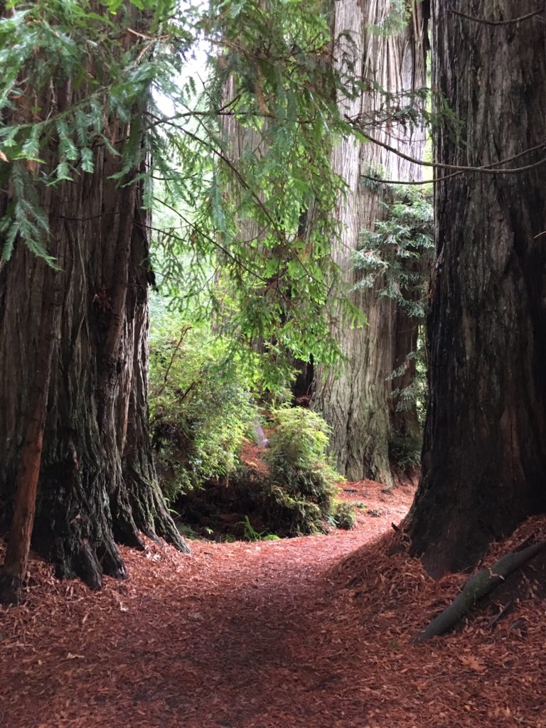
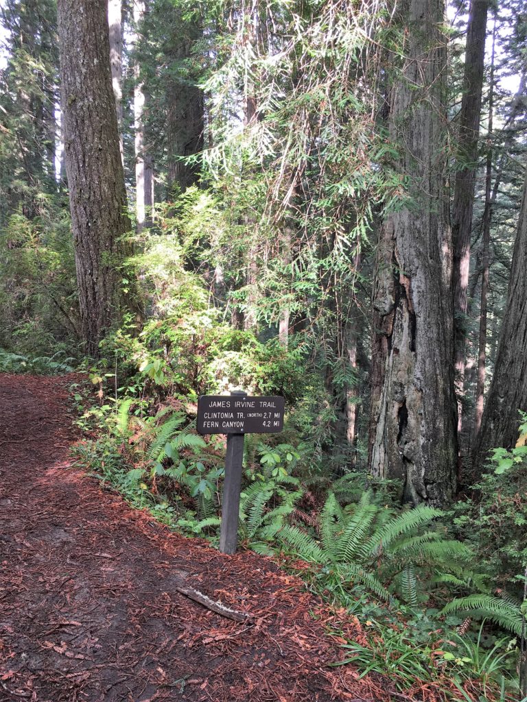
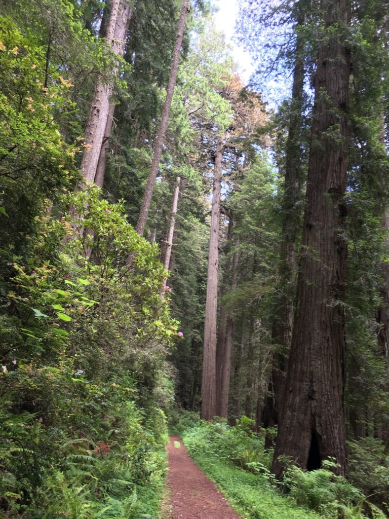
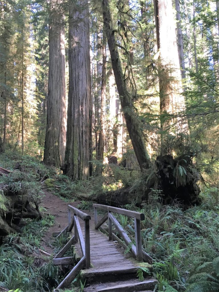
Prairie Creek Redwoods is just north of Redwood National Park and has many trails through fine redwood forests. The great trail network starts at the visitor center and there are also a lot of trails accessible along Drury Parkway and Cal Barrel Road. Lots of the largest (by volume) redwood trees are in Prairie Creek. The trails near Prairie Creek are relatively flat and then there are some trails going up the hillsides that have nice gradual ascents.
Prairie Creek Redwoods near visitor centerPrairie Creek Redwoods Irvine Trail
7 Del
Norte Redwoods State Park
The heart of Del Norte Redwoods is about 20 miles north of Prairie Creek Redwoods. There are few trails and they are pretty steep. The section of the Damnation Creek trail from 101 to the old Coastal Highway is steep but not very long, the climb out is not a problem. The old Coastal trail at the Damnation creek intersection is very scenic and follows the outline of a big canyon.
Del Norte Redwoods Coastal Trail
8 Jedediah
Smith Redwoods State Park
Jedediah Smith Redwoods is about 15 miles north of Del Norte Redwoods. The Boy Scout trail goes from the east to west end of the park. It has a couple small hills and is about a five mile hike out and back. It is well worth the time and effort, don’t make a race of it and keep your eyes open for many big redwoods, some right along the trail.
Jedediah Smith Redwoods Boy Scout trail eastern sectionJedediah Smith Redwoods Boy Scout trail western sectionJedediah Smith Redwoods Boy Scout trail western end
This article is related to an earlier article posted on this web site, “Distribution of Tree Height in An Old Growth Redwood Forest”. An analysis of recent LiDAR data allows for confirmation and expansion of the analysis in that article.
LiDAR data includes first return and ground points. From this information height above ground can be calculated, typically at the square meter level using average ground elevation and maximum first return elevation within the square meter. From this, derivative products can be created, including color height maps and data tables.
In order to use the LiDAR data for canopy height distribution, I aggregated the results to 20 m x 20 m (400 square meter) tiles. This is used to approximate crown spacing in old growth redwood forests. The maximum calculated height above ground within each 400 square meter area is used to create the distribution graphs. In practice the number of tiles is slightly greater than the number of actual redwood trees, by about twenty percent. This is due to the same tree being included in two tiles.
Overall Results
Most importantly, redwood groves have a variety of footprints but similar distributions of tree height beyond the median height for the grove. Some groves are thin wisps along canyon bottoms (think Big Sur) versus others are broad forests filling both sides of large valleys (think Prairie Creek). But for most groves the very tallest trees in the grove are much higher than average height and the number of trees drops markedly in each ten foot height increment beyond the grove median height.
Redwood forests are amazingly scarce and small. Coming out of the latest glacial maximum redwoods were few in number, then filled in a shifting northward range that represented just 2,000,000 acres in a 500 miles long by average six miles wide thin rectangle just inland of the Pacific Ocean from southern Oregon to Big Sur. In this range the needed blend of rare winter freezes (as redwoods cannot propagate by seed in areas with regular winter freezes) and regular intraday offshore to onshore summer fog (as fog hydrates the tall crowns of redwoods but lots of sun is also needed) occurs. Today’s remaining 100,000 or so old growth acres cover about the same range but in remnant patches, almost all in parks.
Second, redwoods grow tall in good habitat throughout their range. Three-hundred-foot redwoods can be found from Big Sur to southern Oregon, and 328-foot (100 meter) redwoods can be found from the Santa Cruz Mountains to the Smith River near Crescent City. Then the 50 or so tallest, those over 360 feet, can be found in Humboldt Redwoods State Park (about 33), Redwood National Park (about 13), and Montgomery Woods Reserve (about 4). Prairie Creek Redwoods State Park and Jedediah Smith Redwoods State Park may also each have one or so 360-foot trees.
Third, old growth redwoods follow similar height distributions beyond a midpoint which is much lower than the maximum height in any particular grove. The median height in a grove is typically 250-275 feet tall, with 300-foot redwoods often common and redwoods over 340 feet relatively rare. When reviewed at the hectare level, the tallest canopies are around 340 feet median height.
The shortest trees reaching the canopy may be about 150 feet tall, there is no zero point. This makes the distribution a truncated normal distribution, not a normal distribution. The canopy height distribution does follow a near normal distribution to the right of the canopy height midpoint.
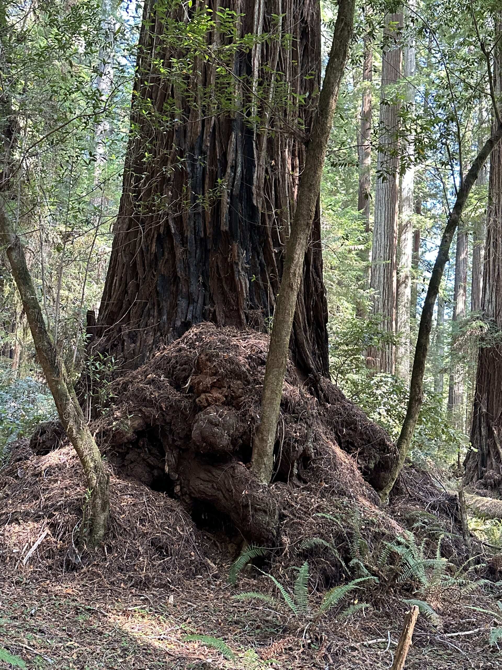
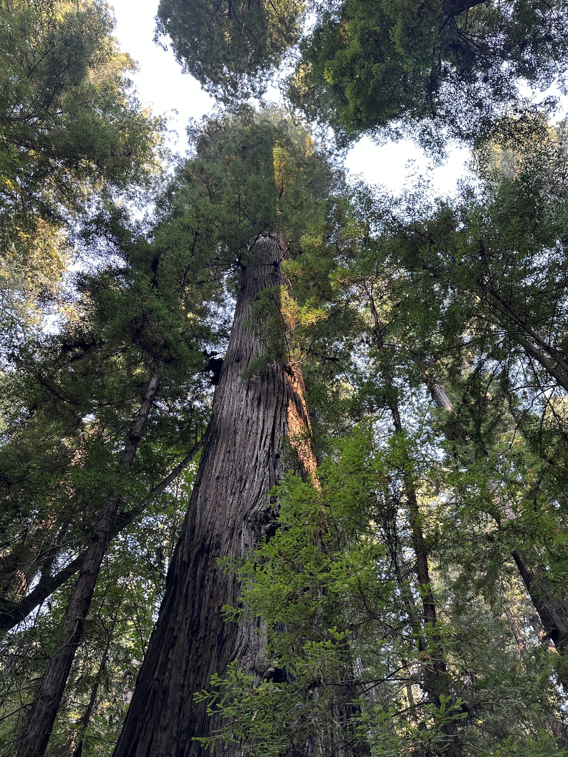
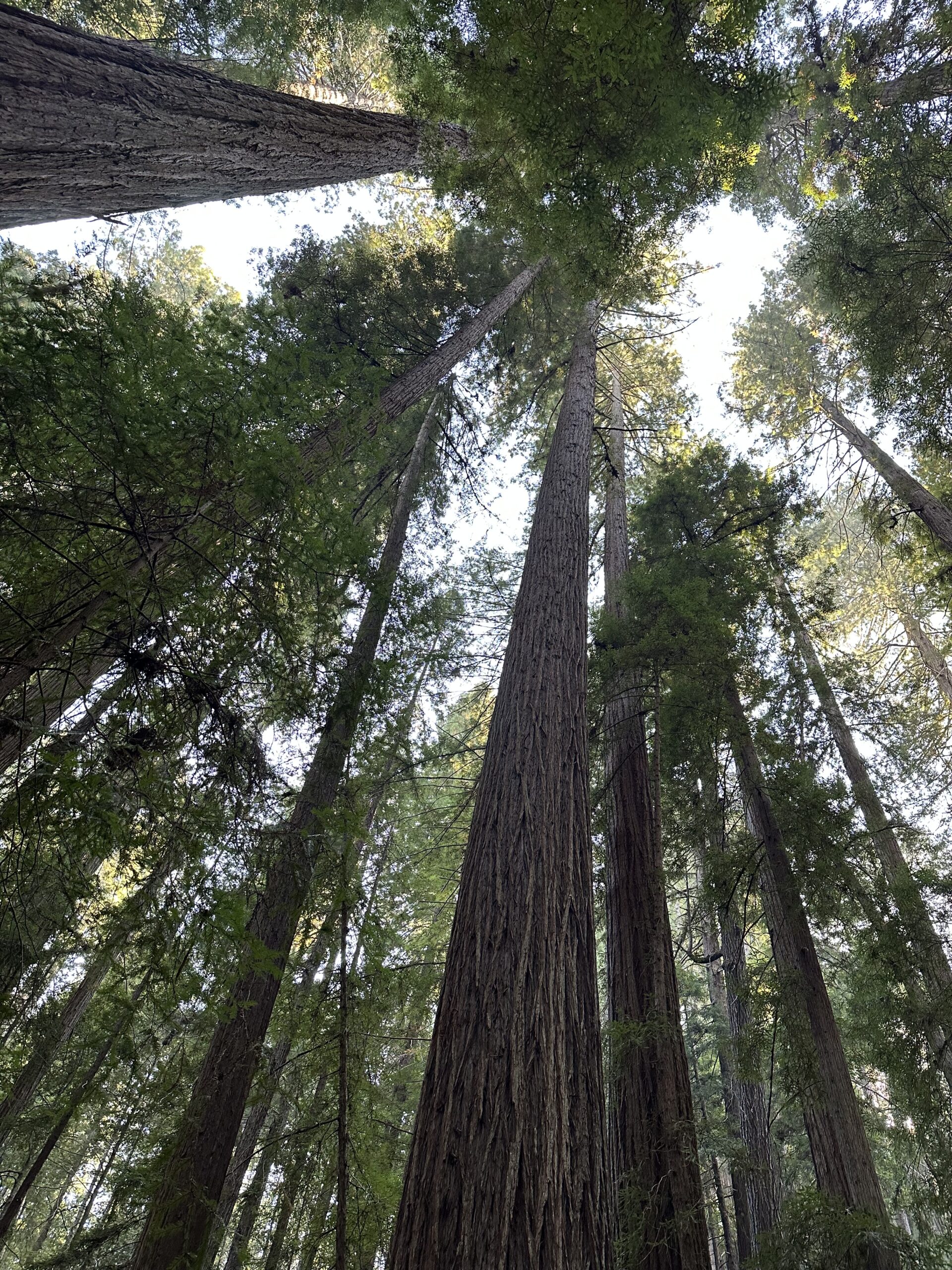
Fourth, the tallest redwoods tend to clump together within groves. Reasons could be local light advantage, a local underground water source, common genetic specificity, or exceptional local soil conditions. The majority of the tallest redwoods have locally tall trees adjacent or nearby. The tallest redwoods tend to grow in groups of two, three, or four, with their tops twenty to thirty feet above the other tree tops in the same area. This is especially true on flats where the canopies are continuous rather than on slopes where the canopies tend to be emergent.
Demonstrated Canopy Height Distribution
The first area assessed are the Bull Creek and Eel River groves in Humboldt Redwoods State Park.
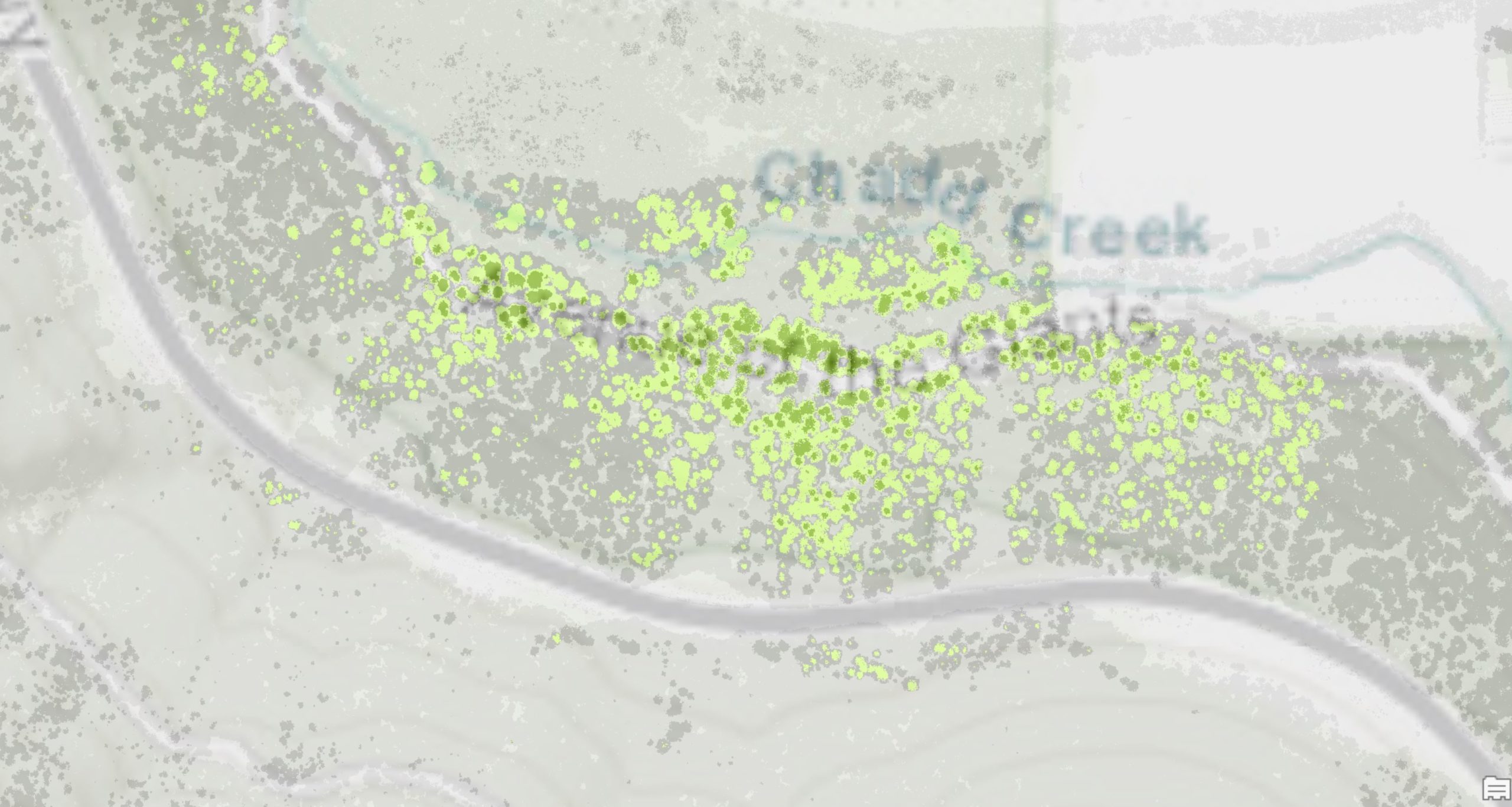
Here the canopy is relatively continuous within groves (in other words very few canopy gaps) with the exception of a couple areas. This is a LiDAR color height map along Bull Creek in the Tall Tree area (Tall Tree / Rockefeller Redwood is in upper right). The area shown covers about 500m x 500m. Yellow is over 80 meters, orange over 90 meters, and red over 100 meters. Here you can see yellows and oranges dominate, with most tree heights in the 275-300-foot range. Then here and there are taller trees, which tend to clump together.
HRSP Tall Tree Area Color Height Map of Canopy (Tall Tree is to Upper Right)
This same pattern is repeated over and over in these groves, resulting in this aggregate canopy height distribution map:
Humboldt Redwoods State Park Old Growth Eel River and Bull Creek Canopy Height Distribution
To highlight what is shown, this is the percent of the canopy over given heights:
Over 280 feet 51%
Over 300 feet 35%
Over 320 feet 16%
Over 330 feet 8.5%
Over 340 feet 3.5%
Over 350 feet 1.1%
Over 360 feet 0.2%
Over 370 feet 0.01%
A top five percent tree is 340 feet tall.
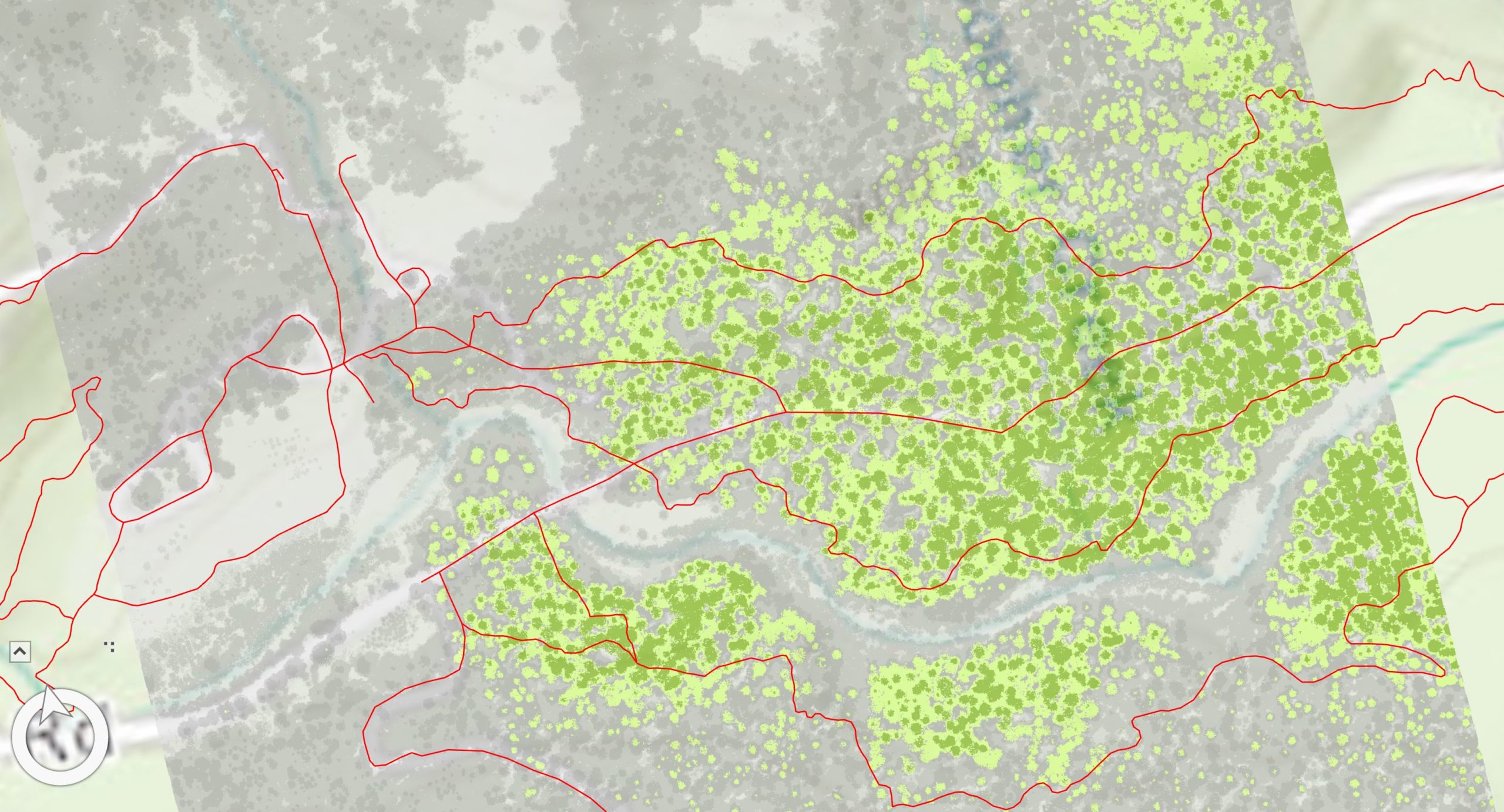
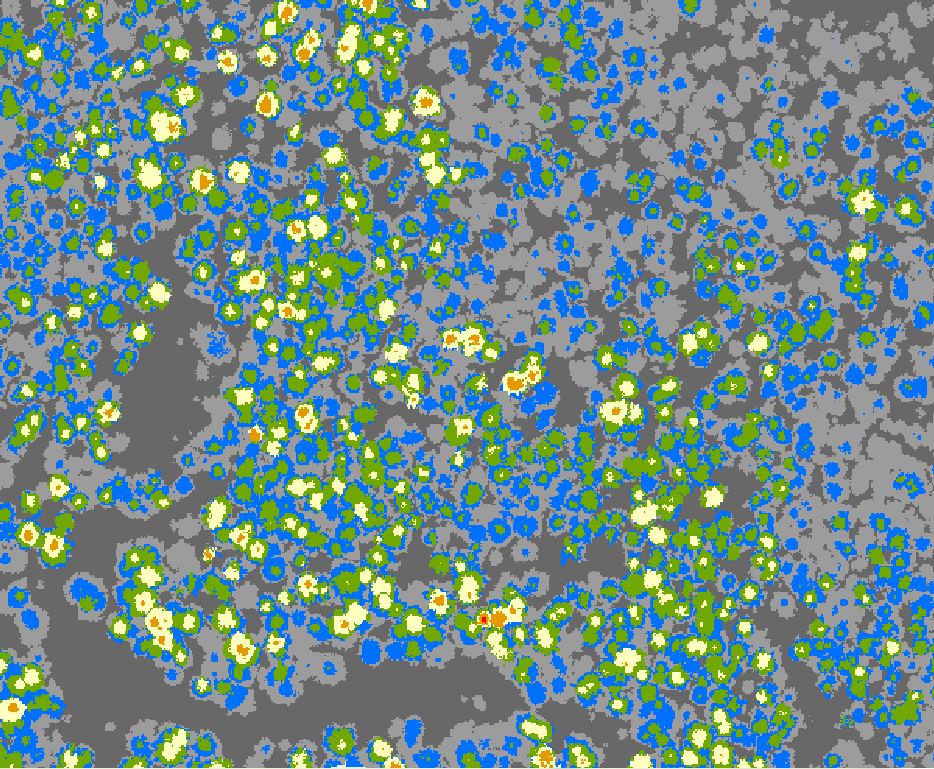
Then the second area assessed is a drainage well north of Humboldt Redwoods State Park. Here the canopy is emergent, there are large gaps with lower heights but certainly many areas with tall redwoods, typically following slopes along and above creeks, which provide good soil and some wind protection. This is a LiDAR color height map of a portion of the valley, covering about a 500m x 500m area. Yellow is over 80 meters, orange over 90 meters, and red over 100 meters. Here you can see yellows and oranges in groups separated by lower canopy, with most tree heights in the 250-260-foot range. Then here and there are taller trees. The tall trees are less dense, more spread out, versus Humboldt Redwoods State Park.
Northern redwood park Color Height Map of canopy in creek valley
A dozen similar areas were then aggregated to create this height distribution chart:
Area of Northern Redwood Park Canopy Height Distribution
To highlight what is shown, here is the percent of canopy above certain heights:
Over 260 feet 54%
Over 280 feet 25%
Over 300 feet 7%
Over 310 feet 3%
Over 320 feet 1.2%
Over 330 feet 0.3%
Over 340 feet .07%
Over 350 feet .03%
A top five percent tree is 310 feet tall.
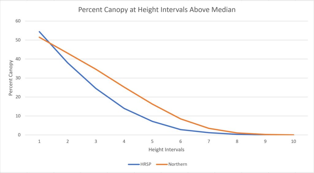
Putting HRSP and the northern redwood park area together in a graph of ten-foot height intervals above median height, it is evident both follow a similar distribution up to the tallest trees. This is likely true when reviewing other old growth redwood areas.
Height Distribution Ten Foot Intervals Right of Median
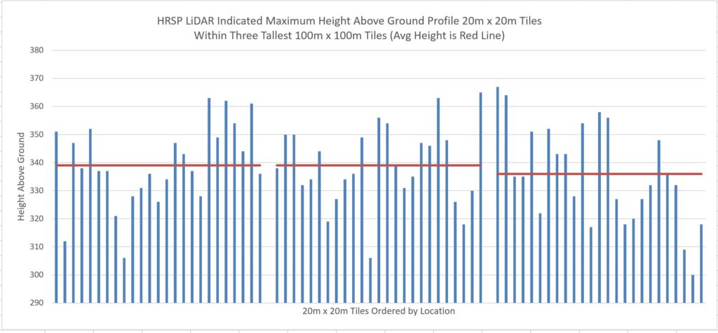
Finally this is a chart showing the canopy cross section in the three tallest 100m x 100m (hectares) in Humboldt Redwoods State Park. As noted earlier, the tallest trees tend to grow adjacently and are twenty to thirty feet above the average height in the local (one hectare) area.
Height Distribution HRSP Tallest Hectares
Redwoods became rare coming out of the latest ice age, then old growth redwoods became much, much rarer after commercial harvest. Then within remaining old growth areas, the tree heights follow a truncated normal distribution, with decreasing numbers of trees for each ten foot increment above the local median. Then the tallest trees, those over 340 feet, are very uncommon and tend to clump together in very specific areas having the most optimal growing conditions.
Redwood thunder is an uncommon but not rare event. It occurs when a large redwood tree falls to the forest floor, sometimes striking and taking other redwoods, firs, spruce, oaks, and maples with it. A cubic foot of redwood weighs 50 pounds, so if a moderately large 20,000 cubic foot redwood topples that is a million pounds, or 500 tons of wood crashing to the earth.
For redwood thunder to occur usually soaked soil and wind are required, though if the tree fractures on itself soaked soil is not an ingredient. Sometimes before redwood thunder occurs the tree will lean against an adjacent tree, with the trunks and branches rubbing with the wind and making screeching sounds like giant stringed instruments.
All redwood trees eventually topple, or at least break off down to a low point on the trunk. If a given old growth redwood has a one in a thousand chance of falling in any given year than that means, based on acres of old growth redwoods, the average annual tree fall count in the large redwood parks is about 300 trees, per park.
If there are multiple trees involved in a tree fall or if the tree falls across a creek, the tree fall is noticeable in Google Earth. If you hike the same trails over several years you will for sure see trees that have recently fallen. Their upper trunks are huge and their logs run sometimes more than a football field along the forest floor.
`
2 Examples of Tree Falls
Here are several examples of tree falls I ran across in 2016. Included are a picture I took of the tree fall accompanied by before and after Google Earth views of the tree fall areas (using Google Earth historical imagery).
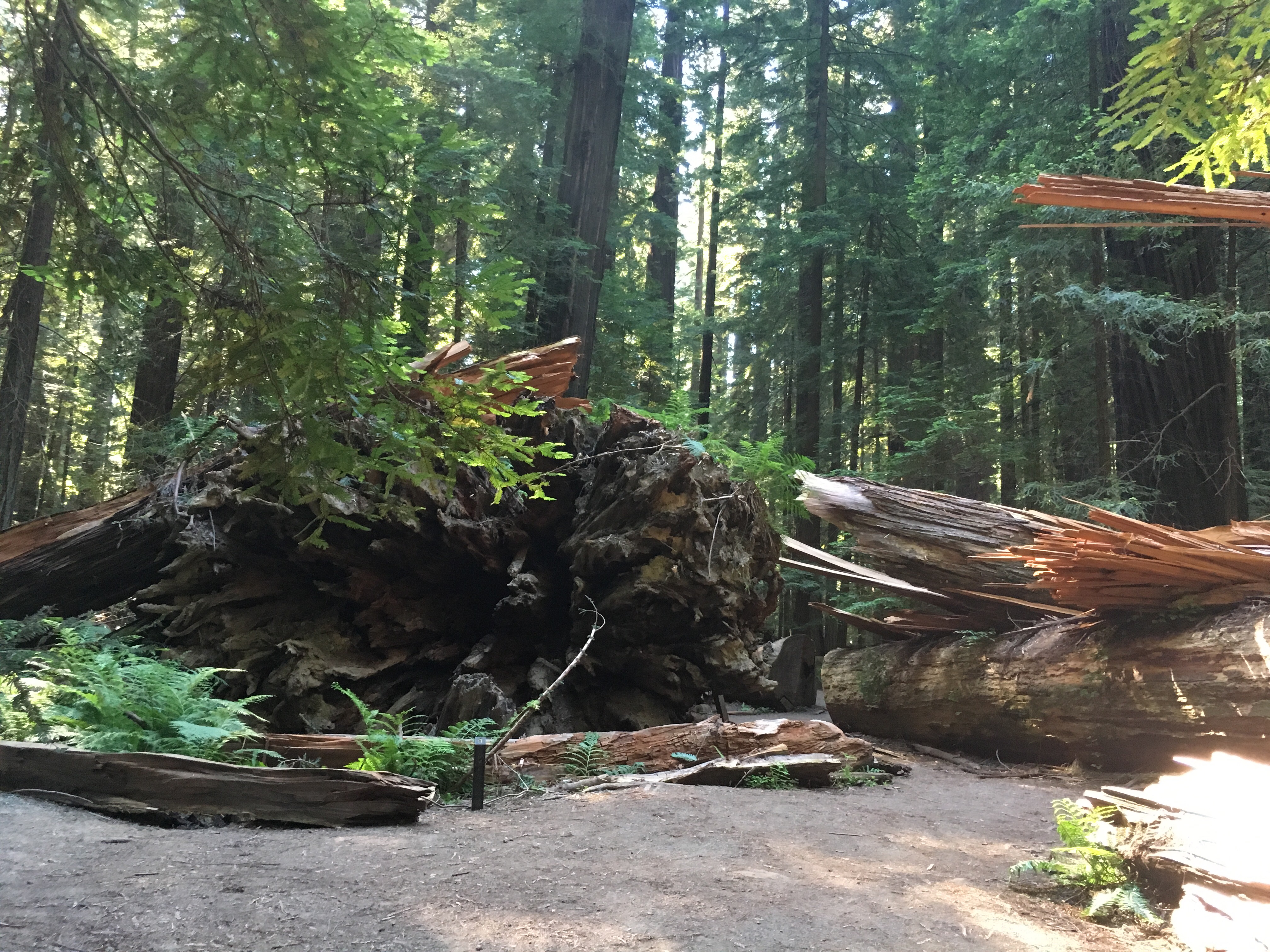
In Humboldt redwoods a neighbor of the big Dyerville Giant log fell in the late spring 2016. Its trunk shattered and splintered into sections where it struck the Dyerville Giant log.
Tree fall across Dyerville Giant in Founders Grove
Founders Grove – tree to fall marked with X. (Image from Google Earth)
Founders Grove – space left by fallen tree marked by X. (Image from Google Earth)
Another recent tree fall in Humboldt was in the area where a seasonal foot bridge is put in to link the Rockefeller Redwood area to the Giant Tree area on either side of Bull Creek in the upper Bull Creek Flats. The new big log is used a lot to cross the creek, though it would be a pretty tough eight foot or so fall from the log to the rocky creek bottom if your foot or the bark slipped.
Log across Bull Creek in Giant Tree area
Bull Creek Giant Tree area – tree to fall marked with X. (Image from Google Earth)
Bull Creek Giant Tree area, empty area where fallen tree was standing marked with X (Image from Google Earth)
A third fall in Humboldt occurred in Harper Flat. The tall north side of a twin trunk redwood fell in the last couple years.
Harper Flat fallen tree, north side of pair (still from I Phone video)
Harper Flat – tree to fall marked with X (Image from Google Earth)
Harper Flat – area left by fallen tree marked by X (Image from Google Earth)
The final example is in an area of tall hillside redwoods on the east side of Redwood Creek a little north of McArthur creek near the seasonal foot bridge. Here the tree fall took out a number of redwoods and the whole group of fallen trees is slowly sliding down toward Redwood Creek.
Redwood Creek tree fall area, trees are slowly sliding downhill.
Redwood Creek east hillside above north seasonal foot bridge, trees to fall marked with X (Image from Google Earth)
Redwood Creek east hillside above north seasonal foot bridge, area where trees stood marked with X (Image from Google Earth)
3 What Can Be Learned From Fallen Redwoods
A recently fallen redwood is a great opportunity for whole tree research once the soil in the fall area has stabilized. The root system and affixed soils can be studied without any digging, this is the big primary benefit. But also core samples can be extracted without having to climb and core living trees. The canopy structure can be measured and reviewed without climbing and an unlimited amount of destructive sampling can be done.